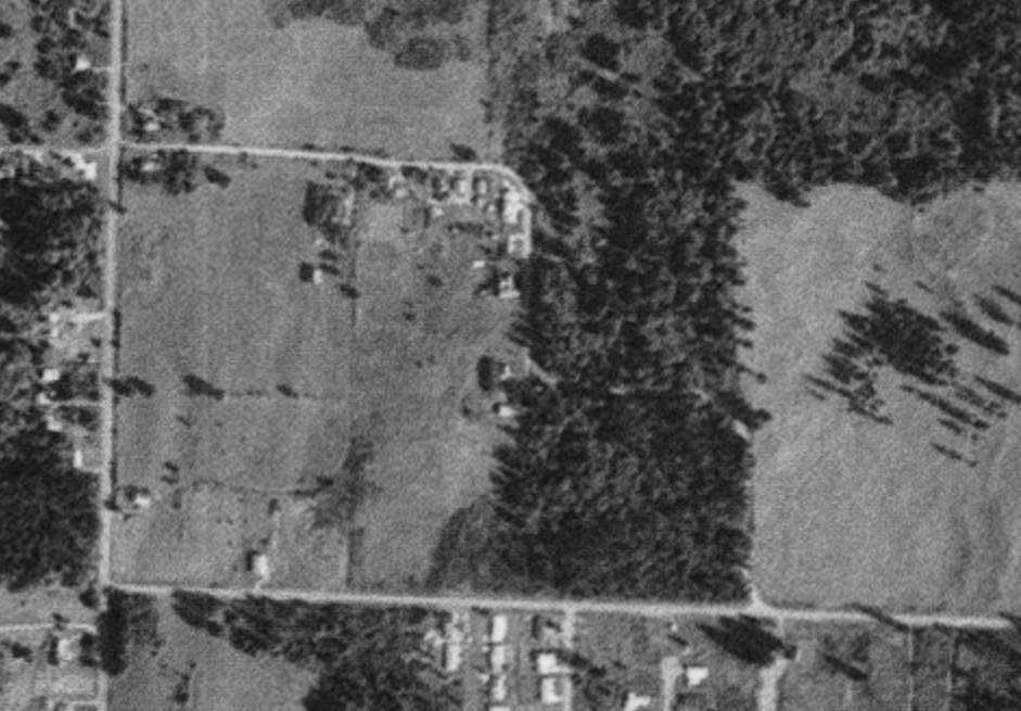
I grew up on Wilson Street between 18th and 22nd, right across from the old Olympia School District bus barn.
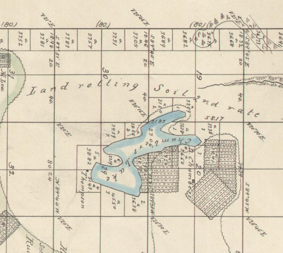
On an 1856 township map, the land in what would become this part of Olympia doesn’t even have a name. The surveyor noted that the ground was rolling, the soil was second rate, and the trees were fir and cedar. Nobody thought it was anything special.
When I grew up there, I got everywhere on foot, on a bike, bus or in the back of my parents’ car. We usually headed straight downtown on the bus or in our car toward St. Mike’s for mass and school.
But sometimes we went south down Boulevard toward Yelm Highway. In the 1980s, there wasn’t much out there. Boulevard south of 22nd was mostly open farmland with a few isolated houses and developments (not even neighborhoods). It was so rural that when we walked our dog down the road to the Boulevard Vet, he’d spot a horse in a field and panic, convinced he’d found a giant, terrifying dog.
That area had a specific kind of rural feel, similar to Rich Road today. You’d see subdivisions popping up alongside hobby farms and single houses on ten-acre lots. Suburban growth was slowly taking over the countryside. Washington passed strong growth management laws later to stop this kind of piecemeal building. If those rules had existed ten years earlier, southeast Olympia would look completely different today.
Instead, it turned into the most car-dependent part of the city. There’s almost no commercial life except for a few stores near 18th and Yelm Highway. It feels like a neighborhood without a real center.
You can still spot traces of the old rural landscape underneath the pavement if you know where to look.
Take Old Morse Road, for example. It’s a short, narrow stub running between 30th and a city path near Boulevard. That stub is the last remaining piece of a dog-leg dirt road that used to connect Boulevard with Morse Merryman across farmland.
Boulevard itself has an interesting history. Developers in the 1890s named it Grand Boulevard because they planned a massive new district. Then an economic crash hit the area right after statehood and crushed those plans. The “Grand” part was dropped, and the road slowly crept south over the decades until it finally reached Yelm Highway.
Morse Road got its name from Harry Morse, who farmed across from where Washington Middle School stands today. You can piece his life together from old newspaper snippets. In 1918, the county hired him to build a road fence, and later that year he sold a cow and put out an ad for six pigs. By 1922, he wanted to trade his 28 acres in what would be SE Olympia for a smaller plot, and his family eventually moved out to Long Lake. He spent the rest of his life working timber, raising livestock, and dealing with family tragedy. His son Roy was killed in a logging accident in 1930. Harry moved to Black Lake in 1931 and lived there until he died in 1955. It’s striking how someone can get a street named after them and leave behind mostly classified ads.
Those old newspaper ads also capture the neighborhood’s shift. Before World War II, people on Morse Road advertised farm gear, cows, and horses. After the war, the ads listed ten-acre lots and single-family suburban homes.
The area was also at the center of a long border dispute between neighboring cities.
For about two months when I was a kid, my house sat inside the City of Lacey before the state Supreme Court ruled it was part of Olympia. As suburbs expanded after the war, Olympia started annexing surrounding land. Neighboring communities got nervous and decided to incorporate as their own town. In 1963, the proposed border for Lacey ran all the way west to Boulevard Road, three miles further west than where the city line sits today.
In 1964, Olympia began annexing land eastward toward Lilly Road. Residents near Boulevard Road voted against joining Olympia, and Lacey’s first attempt to incorporate failed that summer. But when Lacey successfully incorporated two years later, its fire district already covered Boulevard Road, so it made sense for the area to join Lacey.
Olympia moved fast to reverse that. A month later, residents in western Lacey petitioned Olympia to annex them. Olympia accepted and used a forgotten 1890 law to hold a citywide vote on taking the land. Lacey sued, but Olympia won the vote and absorbed the neighborhood, extending its border all the way to College Street.
Lacey fought the annexation in court, arguing that the land wasn’t properly connected to Olympia. The courts rejected the lawsuit because the old 1890 law was still valid. That’s how my family’s block ended up in Olympia. In 1969, state lawmakers finally updated that ancient annexation law to prevent similar fights.
That legal update came right before Olympia and Lacey voted on whether to merge into a single city. The merger failed in both towns. In Olympia, it lost by fewer than thirty votes. In Lacey, voters overwhelmingly rejected it, except for two precincts near Panorama City. Most residents in the Boulevard area clearly preferred being part of Olympia.
Briarwood was the first major subdivision built here after annexation. What people call Briarwood today is actually four distinct phases of housing that expanded north from Morse Merryman over several decades. That slow expansion would be the force that cut up Morse Road, leaving it as a dead-end stub.
Developers skipped the traditional grid layout because urban planning had changed. Between the 1920s and 1950s, planners started favoring curved streets and dead-end cul-de-sacs. They wanted to protect kids from fast traffic. Federal housing guidelines in 1936 even penalized grid patterns. Curved roads were also cheaper to build because developers could follow the natural hills instead of leveling the terrain. People also loved the idea of quiet, tree-lined streets that felt like living in the country.
Residents moved out here for that quiet rural feel that was quickly eaten up by suburban traffic, and old rural Morse Road got in the way of new developments.
In September 1976, seven neighbors spoke out against a developer’s request to close 550 feet of Morse Road. They worried that closing the street would turn their road into a dead end. Other neighbors rejected a proposal for a new connecting street for the same reason. City officials put the project on hold until they could figure out a better traffic plan.
Resolving that disagreement took twenty years. The Olympia City Council finally approved closing that section of Morse Road on September 24, 1996. It was a quick vote on the consent calendar during a meeting where council members were also starting their first discussions about climate change.
The quiet decision to carve up Morse Road was explained months later during a flare up in a February 1997 city council meeting over a proposed street connection between the nearby Cove Subdivision and Holiday Hills. Residents voiced sharp concerns, pointing out that opening the road would dump excessive traffic onto narrow streets lacking sidewalks, exacerbate dangerous sight-distance hazards, and threaten nearby streams and wetlands. While city traffic analysis estimated the connection would add roughly 100 peak-hour vehicles, officials ultimately listened to the neighborhood’s pushback. The car-centric design of this part of town built fear and more cars because we needed them to live here. Rather than forcing a full vehicle thoroughfare and allow a minor relief for some other road, the council opted instead to build a pedestrian path, maintaining local quiet while preserving a walkable link between the developments that really didn’t have anywhere to walk to.
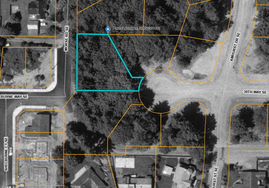
The old Morse Road was finally broken apart when Briarwood 3 was built in the late 1990s. Workers cut the original route at a curve, replacing the road with two home lots and a narrow walking path between them. The northern piece became 30th Avenue, while the middle section was renamed Old Morse Road. Another piece became 30th Way, and the southern stretch was renamed after Margaret McKenny Elementary School.
Naming a suburban roadway after Margaret McKenny feels like a strange irony. She was the city’s leading naturalist, a relentless advocate for getting outside on foot to study native plants, fungi, and mosses. Plastering her name onto a stretch of asphalt turns a lifetime dedicated to wild places into a marketing hook for housing subdivisions. The road itself stands for the exact kind of sprawl and habitat loss she fought against while protecting places like Watershed Park or the Nisqually Delta. In the 1950s, her biggest civic victory was stopping downtown progress in its tracks, rallying locals to block plans for a parking garage underneath Sylvester Park. Attaching her memory to a car-dependent neighborhood street quietly undermines her work, trapping her legacy in the very pavement she opposed.
Briarwood kept growing north and connected with other new subdivisions like Rossmoor, Castlewood, the Birches, and Briar Glen. Together, they formed a massive neighborhood of isolated cul-de-sacs. Instead of a connected grid, the streets spread out like a hand with broken fingers that don’t touch.
The winding streets succeeded at keeping local traffic low. But while traditional grids distribute cars across many parallel streets, this layout forces every car from every cul-de-sac onto a single main road. Cutting off neighborhood connections made walking everywhere impractical, forcing us to drive for every errand. All those car trips jammed onto Boulevard and Yelm Highway, causing traffic and wider roads that ultimately destroyed the quiet rural character people originally moved here for.
We can’t rebuild old Morse Road or undo decades of suburban growth. The real focus should be on improving the neighborhood we have today.
I want to write more about this idea with a terrible name, suburban retrofitting. This means bring back traditional elements into neighborhoods with wide, useless lawns, cul-de-sacs and dead streets.
Simple changes could make a big difference. Like adding Accessory Dwelling Units was a radical idea thirty years ago, we need to lean into the idea of adding Accessory Commercial Units. Adding a small corner market or café would give people a destination to walk to.
The one good thing about the ghost of Morse Road was that some of it was preserved in the form of a walking path between two isolated neighborhoods. Obviously a good thing when there is a school nearby. Once we give people a place to walk to in these neighborhoods, cul-de-sac to cul-de-sac walking paths should become the norm, not the exception.
Connecting cul-de-sacs with walking paths and bike trails would restore convenient shortcuts using existing public land. I would be remiss if I did not point out that we’ve already updated our zoning to allow duplexes or accessory dwelling units, adding more flexible housing options as our needs change.
Again, I don’t think it’s worth much to imagine Morse Road whole again, or to run the counterfactual where we protected the farms, or built densely, or traded some privacy for something in common. The question is what to do with what’s here.
What began as second-rate timberland on an 1856 map gradually transformed into a quiet farming corner, only to be sliced up by mid-century suburban developments and political boundary fights. As curved cul-de-sacs replaced the traditional street grid, old dirt routes like Morse Road were fragmented, leaving behind a car-dependent landscape isolated from local businesses. We won’t undo decades of suburban sprawl, retrofitting these neighborhoods with small commercial spaces, flexible housing, and interconnected walking paths offers a practical way to restore the walkability and community life.


Leave a Reply