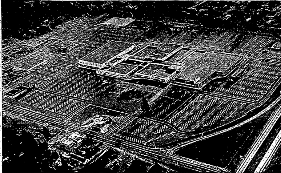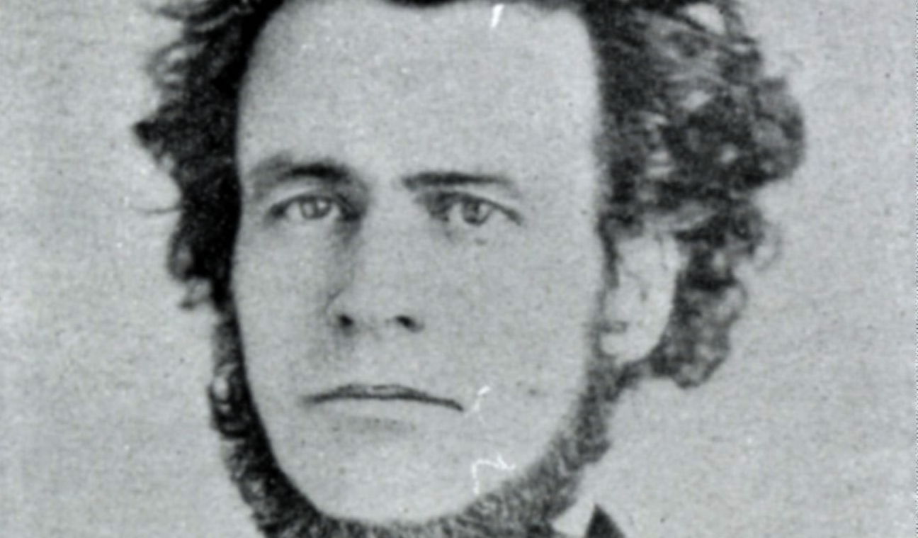
Last week, when I wrote about the sale of the South Sound Center by Bob Blume’s family to a real estate developer quietly closed a chapter for a region whose very geography Blume had shaped through his mid-century ambitions. He’s often called the “Father of Lacey,” and the title fits: he was the son of a janitor who arrived in the South Sound as a soldier and stayed to sell real estate. His vision wasn’t just to build a shopping center. It was to create a new kind of “downtown” for a community that didn’t yet exist.
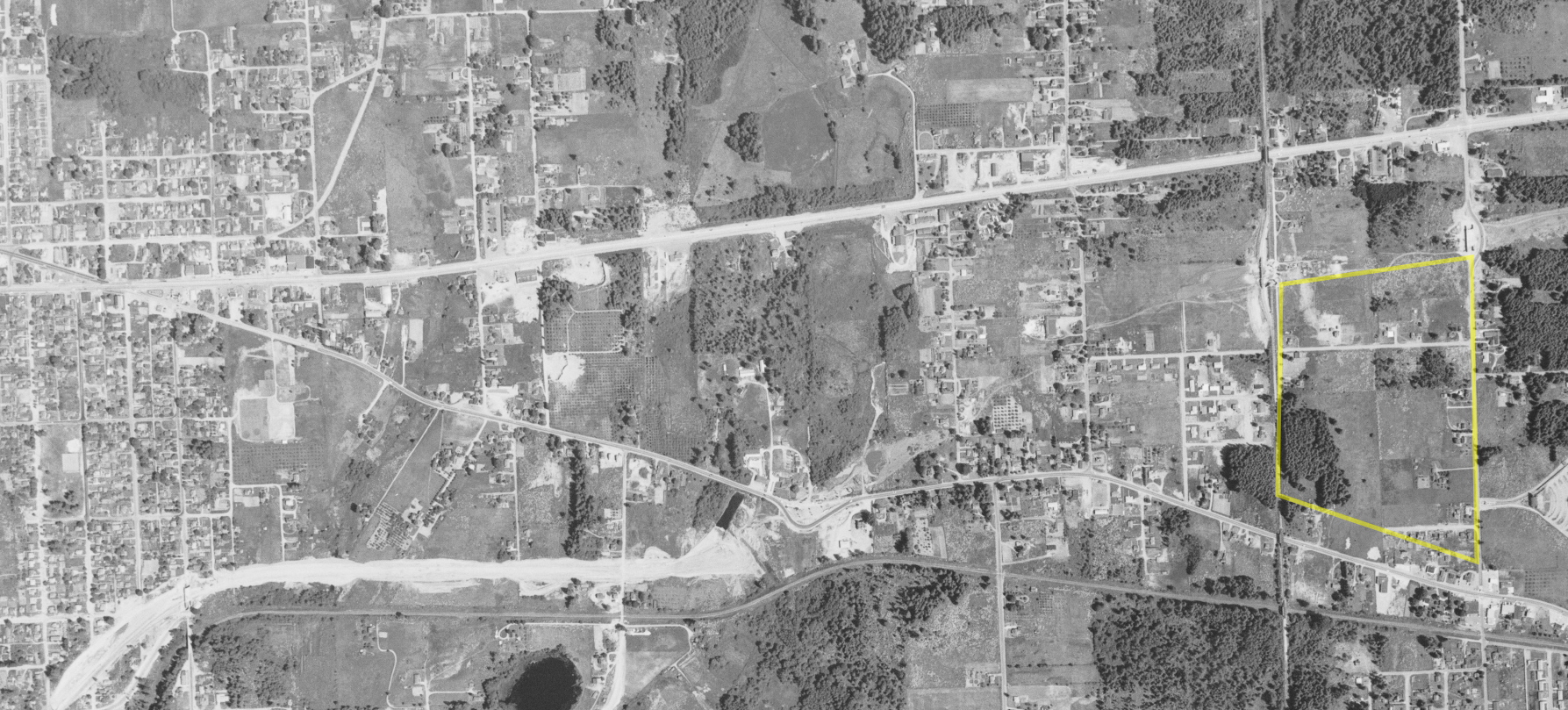
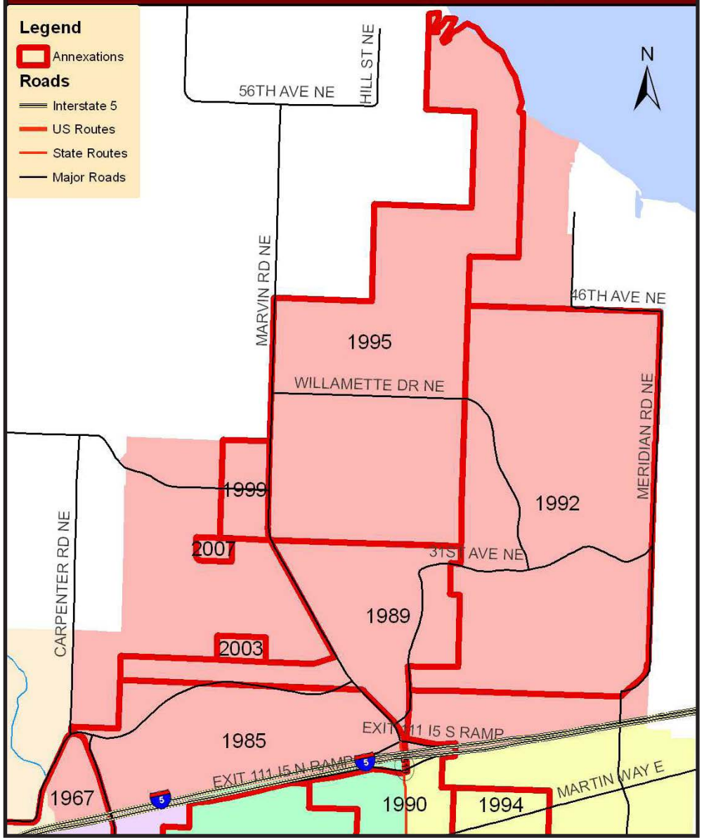
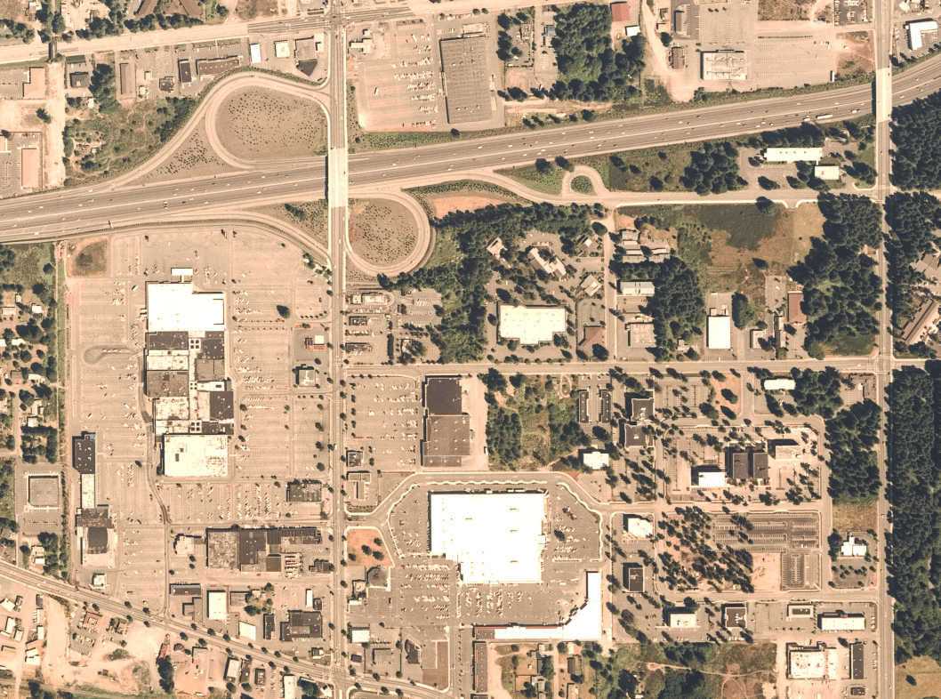
Before Blume, the land east of Olympia was a landscape of “ghost plats,” lots laid out in the 1890s as the “New State Addition,” a traditional grid that was an optimistic monument to a get-rich-quick fever that evaporated in the Panic of 1893. By the 1960s, those residential blocks were still mostly empty, ripe for consolidation. Blume sensed a shift coming. The era of car-based, off-the-cloverleaf retail had arrived, and he saw the newly built Interstate 5 as a “river of commerce,” where every off-ramp was a port for business.
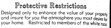
That private vision, though, required public infrastructure that the unincorporated fields of Lacey couldn’t provide. Blume and other local leaders realized they couldn’t afford to build the necessary roads and sewers on their own, so they pushed for Lacey’s incorporation in 1966. The municipality was literally built to support a mall.
For decades, Lacey’s identity was being “whatever Olympia isn’t,” the big-box sibling defined entirely by what Blume started. But sixty years on, the regional “river of commerce” has left a complex and costly legacy that the city is only now starting to work through.
The optimism Blume felt looking at those I-5 off-ramps tracked with a national mood. The interstate highway system was, by the broad numbers, a genuine triumph: it accounted for roughly a quarter of total U.S. productivity growth between 1950 and 1989, and the system is now so woven into the economy that removing it would shrink real U.S. GDP by 3.9%, a loss of up to $619 billion. But the success of the “river” came at a localized net loss for many of the communities it actually ran through.
The hidden costs of car-centric development are staggering, and they reach into municipal budgets in ways that Blume’s generation never had to reckon with. Sprawl of the kind Blume championed has become a form of wealth extraction from the cities it creates, pushing up the cost of public infrastructure by up to 40% and locking those cities into a structural maintenance burden of roughly $1 trillion a year across the country. Lacey, born from the mall, is now hitting the age where the full bill is coming due.
Lacey at 60: Status Report
Sixty years in, Lacey presents what you might call a Pavement Paradox. The 2025 State of the Streets report shows an average Pavement Condition Index of 84.6, with 96.8% of the city’s roads rated “good” or “very good.” Those numbers look like a success story. They’re not.
The high average is a mathematical illusion sustained by growth. New roads in newly annexed areas are propping up the network scores and hiding the deterioration happening in the city’s older core. That trick is running out of road. To clear the current maintenance backlog and hit an optimal network PCI of 90, the city is looking at a bill of $56.4 million, and if funding stays flat, the network PCI is projected to fall to 72 within a decade.
The city’s physical layout tells an equally uncomfortable story. Blume’s blueprint was built around moving cars quickly, not moving people, and the result is that 43% of Lacey’s street network has no sidewalks at all. In the older residential areas south of I-5, where the city was originally founded and where most of the affordable housing still is, sidewalks are often incomplete or just missing entirely. If you don’t drive, or can’t, the city is hostile territory.
Lacey’s planning documents use a Level of Traffic Stress scale, where LTS 1 is comfortable for all ages and LTS 4 is a real barrier to getting around.
Pedestrian conditions in the [Urban Growth Area] are predominantly LTS 4… Any roadway outside of neighborhoods without pedestrian facilities receives a PLTS of 4.
For sixty years, Lacey grew by building for cars. It’s now hit a point where it can’t widen its way out of congestion.
The city’s response has been to essentially reverse the Blume Blueprint. Lacey has moved away from a purely car-focused model toward a managed, multimodal approach, and a big part of that shift is the designation of “Strategy Corridors,” key segments like Sleater-Kinney Road and College Street where road widening is off the table. Instead of adding lanes, the city is going with road diets, roundabouts, and land-use changes to handle growth, trying to preserve community scale rather than giving more ground to the river of commerce. It’s a genuine break from the logic of the 1960s.
The city has also adopted a Multimodal Level of Service guideline that puts walking and biking first, with a new target of getting a low-stress bike route within about half a mile of every resident. That’s a direct response to the isolation that fragmented, mall-centered zoning created over the past sixty years. And by adopting a Safety Action Plan in 2025 focused on cutting serious injuries and fatalities, the city is finally acknowledging that moving cars fast can’t be the main goal anymore.
Lacey at 60 is a city going through a difficult but necessary maturation. It was born as a planning mistake, a municipality created to be the infrastructure arm of a private shopping mall. For decades it took the path of least resistance, building out a suburban auto-landscape that worked at the macroeconomic level but left residents with missing sidewalks, high traffic stress, and a $56 million maintenance backlog. Switching from a vehicle Level of Service standard to a Multimodal Level of Service is the city’s way of saying it’s finally trying to serve its residents instead of its commuters.
The “River of Commerce” built the city. It also cut it into isolated pieces that the current generation now has to stitch back together. Blume’s family sold the South Sound Center and moved on. The people of Lacey are the ones left living in the world he built. As the city looks toward 2045, the challenge is to become a place defined not by its proximity to an off-ramp, but by whether it actually works for the people who live there. The detour has lasted sixty years. The return trip has only just begun.