For the first time in over fifty years, more people in Thurston County live inside a city than outside one. It could be an urbanist success story, zoning reform finally winning out, transit investment tipping the scale toward density. It isn’t. The real story’s older, weirder, and a lot less democratic. Once you see how it happened, I think it’s still worth calling out the right outcome.
This is the post I’m writing about the 2026 release of population estimates by OFM. Every year, the agency releases estimates as a guide for state spending. These estimates also give a picture of the changing shape of our communities.
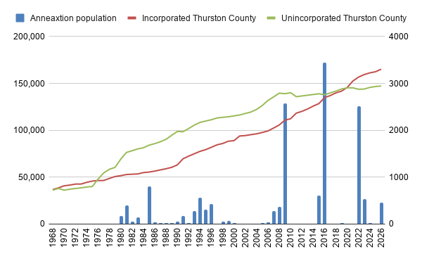
This year’s data shows that between 1976 and 2020, unincorporated Thurston County outnumbered the incorporated cities every single year, a run that held for four and a half decades before it broke in the space of six. The trend started in 1976 because the late 70s saw two record years (in both percentage and raw numbers) of massive in-migration, most of which apparently ended up outside the cities.
But, that trend has finally started to shift But, if this were really about people choosing city life, you’d expect a gradual climb, year over year. Folks being priced out of car dependence drifting toward Olympia, Lacey, and Tumwater one household at a time. That’s not what the numbers show. Instead you get a flat unincorporated population since 2008, a 5,000-person drop in one bizarre year, and then a string of specific years where the incorporated population jumps by two or three thousand people all at once. 2009. 2016. 2022.
Those aren’t migrations, they’re annexations.
Before 2009, annexation in Thurston County was small and constant. Cities picked up a parcel here and a parcel there, mostly empty land, occasionally a few dozen or a few hundred people riding along with it. Lacey, Olympia, Tumwater, and Yelm all added pieces most years, rarely anything anyone would call a headline. Lacey’s 1985 annexation brought in nearly 800 residents. Olympia added just over 180 in 1995. These were rounding errors against the county’s total population, just the ordinary housekeeping of city boundaries.
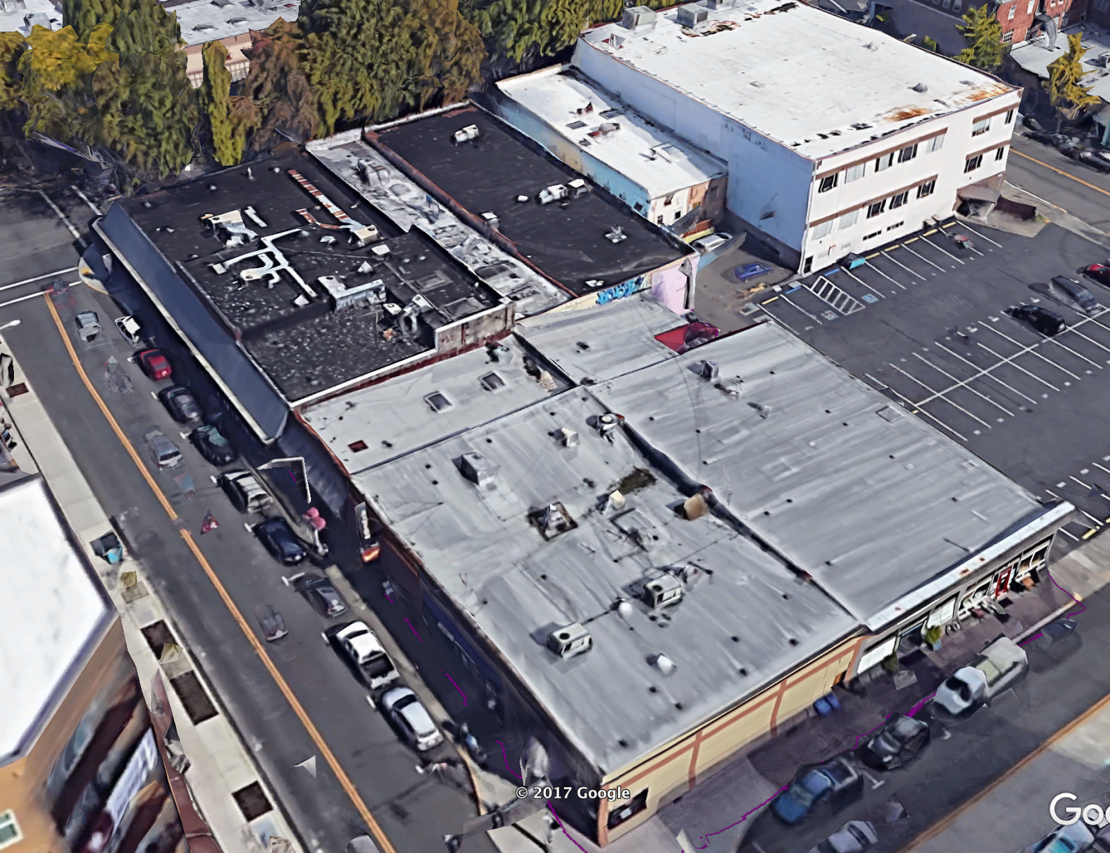
Then the housekeeping stopped and the big grabs started. Tumwater’s annexation, effective February 2008, brought in 2,553 residents in one motion. We’re going to focus on this particular annexation. In my memory, it felt like an existential change for Tumwater, we expected at the time a massive shift in population, that may have happened slower than we expected, given the housing crash a few years later.
Olympia added 562 people in June 2014, a smaller jump but still a departure for a city that usually moved in small numbers. Tumwater came back in January 2016 with the largest single annexation of the last fifteen years, 3,255 residents absorbed in one stroke. Lacey had its turn in 2021, running two separate annexations between May and September that added 1,535 and 978 residents, over 2,500 combined in a single year. Tumwater kept at it into 2022, a dozen smaller annexations in May plus a 332-resident addition in June, while Lacey added close to 100 more that spring. Lacey’s doing it again, with a March 2025 annexation projected to add 455 residents.
Cities were working through a handful of legal tools, deciding case by case and year by year when to catch up with development that had already happened around them. You see a pattern that has nothing to do with a slow cultural shift toward city living.
The old way: leverage, not consent
For most of Thurston County’s modern annexation history, the tool of choice was the Sixty Percent Petition Method. It let property owners representing 60 percent of a target area’s assessed value petition their way into a city on their own. Notice what’s doing the work in that sentence. Not 60 percent of residents. Sixty percent of assessed value. A handful of large landowners, sometimes just one or two big parcels, could decide the governmental future of everyone else living on that land, tenants included.
Where the petition method wasn’t quite enough on its own, cities reached for something even quieter: the “no-protest” utility agreement. Sign one of these to get city water or sewer, and you’d also signed away your right to fight annexation whenever the city decided to come collect.
This is coercive by design, and the state’s own Supreme Court flinched at it once. In 2002, Grant County Fire Protection District No. 5 v. City of Moses Lake found that bypassing a general vote of residents violated the state constitution. For a minute, it looked like the petition method might be finished. The court walked the ruling back not long after, and cities kept using the tool. Tumwater’s biggest annexation wave, the one that added 3,255 residents in a single stroke in 2016, happened well within this post-2002, still-contested legal window.
The fight nobody outside city hall saw
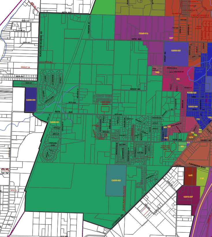
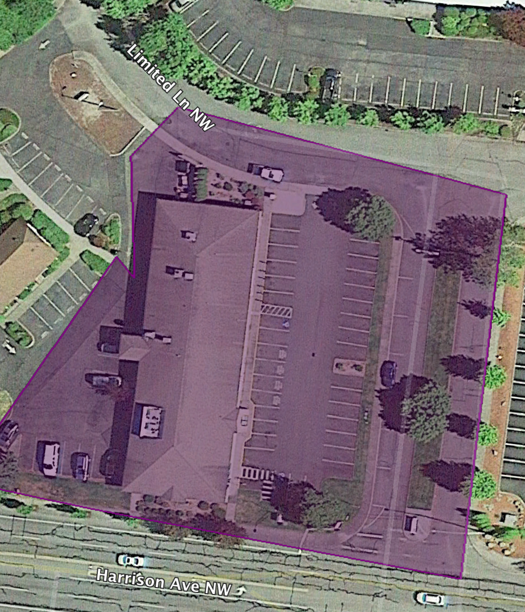
The clearest look at how contested this actually was comes from Tumwater’s 2007 annexation, 1,620 acres that went before the Thurston County Boundary Review Board on a narrow 3-2 vote. The board was one vote from saying no. What flipped it was a last-minute fire service agreement between Tumwater and the Black Lake Fire District, which stood to lose a third of its operating budget once the annexed area stopped paying into it. One dissenting board member called the deal a “shotgun marriage.” He wasn’t wrong. There are real political realities in swapping land between cities and the county, between special districts and city agencies. But, the decline of a rural special district and agreements based on you getting city water are not bad things.
Why the leverage was still the right call
Here’s where I land, and I think it’s a harder position than just cheering for density. The land inside that 1,620-acre annexation wasn’t all farmland waiting to be paved. It was already suburban, already built at a density and a distance from city boundaries that made a rural fire district and a county road department a worse fit for it than a city government with sewer lines already running past the property. The petition method and the utility agreements were ugly tools, built to let city and landowners jump the line without asking anyone’s permission. But the outcome they produced, in this case, matched governance to a landscape that had already been built. That’s not nothing. A fire district’s claim to keep serving an area doesn’t automatically outrank the question of who can actually do the job better once that area looks and functions like a city. If a city can run water, sewer, fire protection, and roads to a piece of land more efficiently than the county patchwork that grew up around it by accident, the district losing its slice of that territory isn’t an injustice. It’s a service boundary catching up to reality a few decades late.
That’s a different claim than “annexation is democratic,” which it mostly wasn’t. It’s a claim that the state spent thirty years building an escape hatch, that city services should follow city-level density, and that the escape hatch got used, however roughly, to reach that outcome.
The state noticed too
The more interesting shift, and the one I think will matter more going forward, is that leverage isn’t the only tool anymore. After 2002, the state built the Alternative Petition Method, which requires signatures from a majority of both property owners and registered voters, a real check the old method never had. Then came the Interlocal Agreement pathways, letting cities negotiate directly with counties over revenue sharing and infrastructure before annexing anything. In 2023 the legislature revived a sales tax credit specifically to pay cities for absorbing unincorporated growth areas over 2,000 people.
Boundary Review Boards are disappearing too. Spokane disbanded its board in 2012. Lewis County did the same as recently as 2026. The fights those boards used to referee are increasingly handled through negotiation instead of a contested vote.
Right around the time the old, coercive tools had already finished most of the job, the state built better ones.
What I can’t prove yet
I’d like to end this by telling you that all of this points toward a walkable, mixed-use future for Thurston County’s cities, third places and multimodal streets slowly replacing the cul-de-sacs that got annexed.
I can’t actually back that up.
Annexation moves a jurisdictional line, nothing else. It doesn’t retrofit a sidewalk or rezone a strip mall. Everything in this record shows governance catching up to sprawl, not sprawl getting undone. The most honest thing I can say is that Thurston County’s cities now have the tools, and increasingly the financial incentive, to govern the suburban land they’ve absorbed. What they choose to do with that authority, whether it produces the kind of denser, more human-scaled development that we want, is still an open question. That part is hope, not history.


