There’s a version of Olympia where you step off the commuter train at 7th Avenue and walk up into daylight at what was an old Greyhound station. You’re already downtown. You wait four minutes for a streetcar, and then 20 minutes later, you’re home. That city was closer to real than you’d think. What killed it wasn’t destiny. It was a series of small, ordinary choices that added up. These are the same choices that killed streetcars and rail mass transit in a lot of places, but we can pull at the threads here and think about what might have been.
The First Hinge: Who Owns the Wire
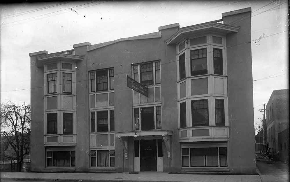
By the 1920s, the Stevens family had built Olympia’s streetcar system. When they sold their stake to what would eventually become Puget Sound Energy, they handed the city’s transit future to a company that had no real reason to care about it.
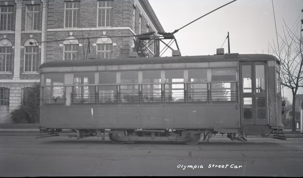
A utility company runs streetcars as a side hustle of selling electricity, treating ridership as an afterthought, and when the automobile started pulling riders away in the early 1930s, non-local owners had no particular reason to fight. In September 1933, the company ended the system, and local government stepped in with a motor bus network. The tracks were pulled up or paved over.
Now imagine the Stevens family sells instead to the City of Olympia, or to a proto-PUD, more than a decade before the Thurston PUD was actually formed. A city-owned system doesn’t need to sell electricity. It needs to move people. When ridership falls, it looks to updgrade the noisy, slow and bumpy cars with something new.
With a few more years to hold on, the solution in our real history was the PCC car, introduced in 1936. A consortium of transit operators, facing the same threat from the automobile, had commissioned the most advanced streetcar yet built: rubber-cushioned wheels, streamlined body, a cellular construction that made the ride smoother than anything that had run on rails before. Cities that were still operating when the PCC arrived had a genuine fighting chance. In this version of Olympia, the city’s system is still running and it gets PCC cars.
Building Out: The 1930s Through the 1950s
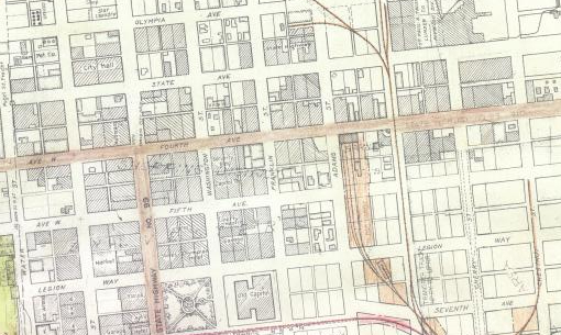
The original Olympia streetcar network was T-shaped, running east to Central Street and west to Rogers. In the years after the system upgrades to PCC cars, the city keeps building it out.
Puget Street gets a spur north to San Francisco Street in 1939, a short southwest line runs down Decatur to 9th Avenue. Eastside Street also gets a spur, and Division is now the terminus of a westside extension.
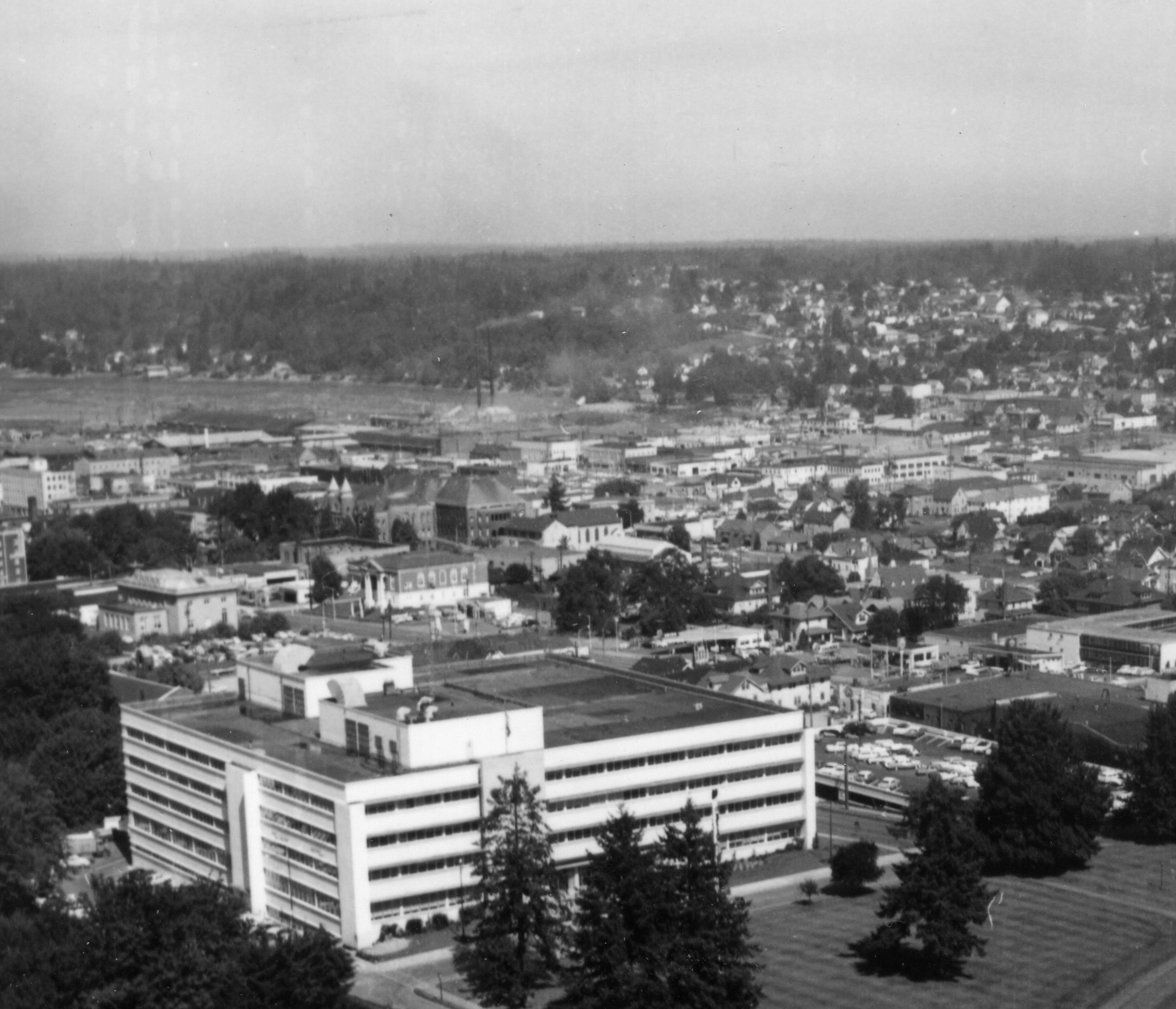
This stable era, the 1940s and 1960s, is when the system becomes something people actually count on. But it also ends as the PCC cars age and car-driven growth starts pushing the edges of Olympia. Interstate 5 does come through, but we need something else to save our rail network.
The Second Hinge: Forward Thrust
In the 1960s, Seattle-area voters were asked to approve Forward Thrust, a package of transit bonds that would have funded a regional rail system running on its own dedicated tracks, built with federal matching funds covering roughly 75 cents of every dollar. In real history, voters said no. The money went to Atlanta, which built MARTA. The Pacific Northwest spent the next several decades building highways instead.
In this history, Forward Thrust passes, and the effects pile up.
A regional rail authority forms decades earlier than Sound Transit did in reality, pulling in federal funds at a scale that was simply gone by the time the real Sound Transit came along.
And Boeing-Vertol, which in real history made a troubled attempt at light rail vehicles for Boston and San Francisco, struggling with chronic problems that plagued the cars for years, now has a well-funded local partner involved from the start. The collaboration produces something that works: a vehicle with smooth propulsion, a lightweight aluminum alloy frame, and a modular design that’s actually easy to maintain. The “Seattle-Spec” LRV succeeds in the field tests by early adopters in Olympia and Seattle. By the mid-1970s, transit authorities in Boston, San Francisco, and eventually London and Melbourne are buying American, and the Pacific Northwest has become an unexpected exporter of rail technology.
For Olympia, the immediate consequence is more modest: the city now has access to modern vehicles and a regional system extending south.
The Great Expansion: 1960s Through the 1980s
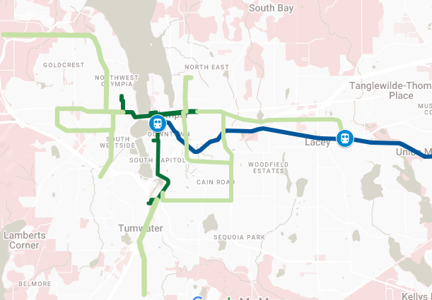
The 1960s and 1970s are when the system finally grows to match where the city has spread, the eastside line pushing out past Boulevard Road to St. Martin’s University, a new line dropping south down Capitol Way into Tumwater, and two loops filling in what the old spurs couldn’t reach: one connecting Boulevard Road with North Street on the outer eastside, another using 22nd Avenue on the interior southeast side. The Division Street line reaches Evergreen State College. South Puget Sound Community College gets connected via the old Black Lake Road grade.
The most consequential development isn’t a new route, though. It’s political. Lacey, which in real history incorporated as its own city in 1966, instead holds an election to re-annex into Olympia. The streetcar is the promise, and service to Lacey is the condition. Lacey becomes a neighborhood rather than a separate city, and because it never fully separates, it never builds up the political pressure for the kind of sprawl that real-history Lacey ended up with. Growth does occur east of Carpenter Road, clustering around Tanglewilde and Thompson Place, but it stays modest
The 1990s Regional Connection
Just as the regional rail system reaches Fort Lewis, extending south from the original Forward Thrust network through Tacoma and Lakewood, Burlington Northern announces plans to abandon the Fones Road line, nine miles of track cutting through what is now Lacey. In real history, that corridor becomes the Woodland Trail. Here, Thurston County holds a public vote to join the regional transit system and grabs the corridor for rail before it’s gone.
The new commuter line is built similar to regional rail around Chicago or Philadelphia. The new expansion connects to the regional system at Dupont and runs into downtown Olympia, with a station in Lacey placed at roughly where Depot Park sits today. The St. Martin’s streetcar line is extended south to meet the regional line. Downtown, the old 7th Avenue subway tunnel gets converted into an underground station, and you rise from it into daylight at the old Greyhound terminal.
The City
The story is about choices: the Stevens family selling to a utility, Seattle voters rejecting Forward Thrust, Burlington Northern abandoning the line, each one narrowing what the next choice could be.
The Olympia in this history isn’t utopian. I-5 still runs where it runs. Where the streetcar system meets the freeway, expensive bridging projects span the road. The car is still present. But the city has a different shape, denser along the lines, more walkable around the stations, more continuous across what in real history became the Olympia-Lacey seam. You can get from Evergreen to downtown without a car. You can get from downtown to Tacoma without one either.
That city was close. History hinges on small choices that expand with time. That’s what makes it worth imagining, not to mourn a future that didn’t happen, but to understand exactly what was given up, and when, and why.