History, politics, people of Oly WA

Category: Olympia history (Page 2 of 10)

Olympia ’57 and the Arts Walk we always needed

Walking through downtown Olympia during Arts Walk this spring, I was struck by a realization:

Arts Walk has become what Lakefair was originally intended to be: a human-centered festival that brings people downtown and supports local businesses. What began in 1957 as a strategic effort by downtown retailers to draw shoppers back from the emerging suburban fringe has evolved, ironically, into something that now seems to conflict with its original purpose. Meanwhile, Arts Walk (especially the spring edition) has stepped into that role and done it better.

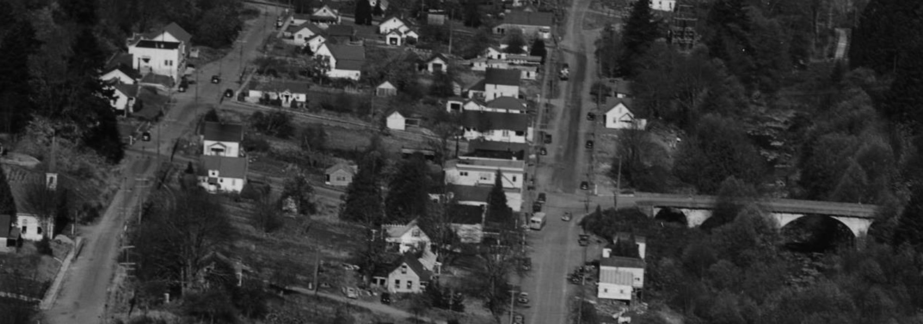
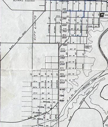
The first Lakefair took place just seven years after the Deschutes River was dammed to create Capitol Lake. Back then, Tumwater as a town stopped short of the Trosper and I-5 cloverleaf, Lacey barely extended beyond a few blocks around the St. Martin’s College campus, and Olympia’s downtown was the regional commercial hub. An aerial photo from 1957 shows a very different city. There’s no westside sprawl, no South Sound Center, no Capital Mall. Interstate 5 is only beginning to cut its path through the city. The southeast side is still a patchwork of empty fields. Downtown was everything.

Lakefair was born into that moment. The lake was new, a kind of novelty. We hadn’t built any parks around it, and people could still remember the squalor of the Depression era shanty town, Little Hollywood, the lake was meant to replace. Downtown retailers felt threatened by the spread of car-centric shopping centers to the south and west, and Lakefair was their answer: a family-friendly summer celebration rooted in Olympia’s historic center.

But the tide couldn’t be held back. By the 1980s, the construction of Capital Mall and South Sound Center pulled national retailers out of downtown. As rents dropped, local and niche businesses moved in. Downtown shrank in economic dominance, but it found something more interesting: being an actual human-scaled neighborhood. By going down, downtown Olympia grew up.

Lakefair, however, didn’t adapt. It stayed focused on big crowds and spectacle. It became a regional summer draw, people come in from Tumwater, Lacey, and the westside not to experience downtown but to experience the event. Today, the foot traffic is enormous, but not helpful. If you talk to people who live and work near downtown, many will say they avoid Lakefair. Ironically, the further someone lives from downtown, the more likely they are to enjoy it, because for some, it’s the only time they come. For those who frequent downtown, Lakefair is an interruption.

Compare that to Arts Walk. It’s right-sized. Embedded in the streets. Both the Friday night Luminary Procession and the Saturday Procession of the Species invite people not just to gather, but to stroll, to explore, and to be downtown. These events don’t shut down the regular rhythm of the neighborhood; they highlight it. Arts Walk brings people face-to-face with small businesses, galleries, performers, and each other. It’s not a performance to be watched from the sidelines; it’s an experience shared from within.

The seasonal timing is meaningful. Lakefair is scheduled for the height of Cascadian summer, long days, hot sun, and school-free weeks. But Arts Walk arrives at the beginning and end of the softer season. Spring Arts Walk, in particular, feels like a true civic ritual: the reawakening of our community after a long winter and a downtown that’s still very much alive.

Lakefair has also changed in ways that move it further from its roots. Food booths once reserved for nonprofits are now open to commercial vendors. Local nonprofits increasingly struggle to justify the effort and expense of participating. And though the Twilight Parade still winds its way through the city, it mirrors the spirit of Arts Walk’s two processions, just with a different energy: one is lighthearted and grassroots; the other, more grand and nostalgic.

There’s a larger parallel here, too. Just as Lakefair took its name and identity from the artificial lake at the city’s core, it may now face a similar fate. Capitol Lake, long celebrated as a civic centerpiece, has been revealed as ecologically harmful—shallow, warm, and lifeless. The planned restoration of the Deschutes Estuary will undo that mid-century engineering mistake, trading a static reservoir for a living tidal system. Something more natural. More fitting.

In the same way, Arts Walk fits Olympia. It flows through the streets, not around them. It thrives not in designated festival zones but in the storefronts, sidewalks, and alleys that make downtown what it is. If Lakefair is to survive in a post-lake Olympia, it can return to its roots. Maybe even borrow a few pages from Arts Walk. Move into the streets. Shrink the footprint. Reconnect with the businesses and people downtown.

I’m not a Lakefair hater. I have fond memories, and I go down there for at least two nights a year for rides, food and fireworks. I know many in our community still love Lakefair, too. But festivals should serve the places they’re held. Arts Walk has become Olympia’s true local celebration, reflecting how we live now, not how we used to.

We are struggling as a city to recover from years of car-dependent development. Most of the square miles of today’s Olympia have no actual places to walk to, we need to get into our cars for everything. The single-family zoning that dominates the landscape removed the housing capacity that used to, more or less, assure everyone had something to call a home. We’re working now to create more density, more actual businesses in our neighborhoods. More sidewalks and more reasons to use them. Call it creating more “people-oriented places” or just human-scale, but looking at what Lakefair was born to fight is actually where our future should be taking us.

Who could own what and who owned what

Sometimes I have an idea (like a few weeks ago) to figure something out, put together a research plan, execute it, and still come up seriously short. That’s exactly what happened the last couple of weeks as I tried to dig into the Alien Land Law and how it worked in Olympia.

One piece of our particular brand of Pacific Northwest racism that I left out of my post a few weeks back was, of course, the Alien Land Law. It existed for nearly our entire history, lasting until 1966, and undergirded much of how we treated racial minorities in the Pacific Northwest.

Long Background on Alien Land Laws

The Alien Land Law in Washington State, rooted in the state 1889 constitution and subsequent legislation, prohibited land ownership by residents ineligible for citizenship. Though seemingly race-neutral in its language, its primary aim was to disenfranchise non-white immigrants, particularly Chinese and Japanese individuals.

Initially, territorial law encouraged non-citizen land ownership to attract white settlers and foreign investment. However, economic anxieties among white laborers and farmers, combined with a rising tide of anti-Chinese sentiment, soon led to laws restricting land ownership for those deemed “ineligible to citizenship,” effectively targeting Asian immigrants who were barred from naturalization under federal law. Later iterations of the law focused even more directly on Japanese immigrants, further restricting their ability to lease or even hold land through their American-born children.

The question I had was: if the laws in Washington forbade Chinese and Japanese families from owning land, how did they operate businesses in Olympia during this era? The Olympia Historical Society points out that dozens of businesses across Olympia were operated by Asian families, though apparently not controlling the land underneath the businesses.

One method involved leveraging their U.S.-born children, which leads us into a reflection on today’s debates about the 14th Amendment and birthright citizenship.

Washington State’s Alien Land Laws initially targeted non-citizen land ownership, focusing primarily on Chinese and later Japanese immigrants. While the original laws didn’t explicitly address land ownership by the U.S.-born children of these immigrants—who were birthright citizens under the 14th Amendment, a loophole soon emerged. Families began purchasing land in their children’s names, allowing parents barred from owning property to indirectly control it through their citizen offspring.

In response, the legislature passed additional laws, notably in 1923, specifically stating that land held in the name of a child of an ineligible alien would be considered held in trust for the parent, effectively closing the loophole. In 1925, the Washington State Supreme Court case State v. Hirabayashi reinforced this interpretation, ruling against the transfer of land-holding stock to second-generation Japanese American children when their parents retained control, deeming it an evasion of the Alien Land Law.

This situation created a direct conflict with the 14th Amendment’s Citizenship Clause. While the 14th Amendment unequivocally granted citizenship to those born within the United States, the Alien Land Laws limited the practical benefits of that citizenship, especially the right to own and control property. It highlighted the tension between the constitutional guarantee of birthright citizenship and state-level efforts to maintain racial discrimination.

This history dovetails with contemporary legal battles surrounding birthright citizenship, particularly efforts by the Trump administration to reinterpret the 14th Amendment’s Citizenship Clause. Just as past lawmakers sought to create exceptions to citizenship rights based on parental status, current arguments attempt to carve out similar exceptions, revealing a recurring tension between constitutional principles and efforts to impose discriminatory limitations.

So Where Does That Leave Us in Olympia?

Who did own the land underneath those businesses?

What I was trying to find out was who the non-Asian families were who supported Asian-owned businesses by leasing or renting land to them. The real research (narrowing it down through property records on microfilm) will take some time. I’ll get to that eventually. For now, I’m content just sketching out the context.

Leasing or renting to Asian families did not escape the notice or ire of Olympia’s more racist white residents. From an Olympia Tribune editorial in the 1890s, we see a call for the expulsion of Chinese residents by legal means, especially by encouraging property owners to refuse to rent to them. The editorial reflects widespread fears among white laborers about job competition and portrays the Chinese community as an unwanted and growing threat. It even calls for the creation of a citizens’ association to coordinate exclusion efforts, promoting the motto: “Olympia for Olympians.”

From a separate, sympathetic article about the populist “People’s Party,” also from the 1890s: “We believe that those who patronize the Chinese are enemies of their white brethren, and we favor strict exclusion and entire letting alone of all Chinese and their sympathizers.”

When I poked around the same newspaper archives looking for records of who owned the land underneath Asian-owned businesses, I came up short. I can only assume that while business relationships were practical and necessary, they were considered perilous enough that few people talked about them openly.

The land owned by Sam Fun Locke’s family at the corner of Columbia and 5th is a good example of this land record puzzle. Locke was one of Olympia’s most successful Chinese businessmen, often called “The Mayor of Chinatown.” After his death, the property was passed along to his descendants. I can pick up the property transfers starting in the 1940s but can’t trace anything definitive before that.

I can, however, track the locations of his businesses through phone directory records, which makes it possible to compare them with land ownership records. That way, I could eventually find out when exactly Locke’s family came into possession of the land, and whether the same family owned it while Locke operated his business there.

So, there’s still more work to do. But this week, at least, I was able to lay out the policy and legal landscape before diving deeper.

Dick Abram and the circle of history

I originally read this as a part of an episode of the Olympia Standard about a year and a half ago.

If you’re a well-informed Olympian, you’re probably familiar with Olympia’s Depression-era “Little Hollywood,” a shack town that existed in the 1930s. Its name was likely an ironic nod to the bustling Los Angeles suburb already then at the heart of the movie industry.

You might also know that Little Hollywood was torn down in the early 1940s to make way for Capital Lake, as most of it consisted of float houses anchored in the old Deschutes Estuary.

But let’s rewind to 1935, at the height of the Great Depression. Olympia hosted what could be called a proto-Capital Lakefair, known as the “Pagan Frolic.” The event included the crowning of Queen Juno and Dan Cupid.

Dick Abram, a contestant in an old-time fiddle contest at what was then known as Priest Point Park, didn’t win first place (which would have earned him $10) or second (a new fiddle). Abram, an itinerant cabinet maker, was living in the old wooden Washington School at Legion and Eastside, the site of what is now the Old Armory. In fact, he lived there until construction workers nearly demolished the building before moving to Little Hollywood.

It was then that Abram became the unofficial “mayor” of Little Hollywood. He rallied shacktown residents to ensure they were counted in the 1940 census.

Though Abram wasn’t originally from Olympia, he was born outside Akron, Ohio, and had lived in Texas and Nova Scotia, he eventually made Olympia his home. He was widowed in 1932 while living in the city.

Abram’s life ended tragically on Christmas Day in 1943, when he was struck by a car near the corner of Fourth and Cherry, where city hall now is. His death was the culmination of years of hardship. As the “mayor” of Olympia’s largest and longest-standing homeless encampment, which was then known as a “shack town” or “Hooverville,” Abram’s life embodied the struggles faced by many during the Great Depression.

In 1937, Olympia residents began to push back against the presence of Little Hollywood. When a local real estate broker first complained about the shack town’s residents living on public land, the city attorney drafted an ordinance to remove them. However, it wasn’t until 1942 that Little Hollywood was completely cleared out, with its float houses and shacks burned to the ground. Abram was forced to move, and his new residence was an unknown address somewhere “north” of Olympia.

Then people started hitting Abram with their cars.

In the following year, 1943, while walking downtown, Abram was struck by a car being driven by another human twice. The second time he died. On Christmas Day, a 20-year-old driver didn’t to see Abram crossing the intersection. The driver turned himself in at the police station but was cleared by the coroner, who determined that Abram had stepped out too quickly and that the driver was not at fault.

Behind Abram’s death were civic efforts to disband Little Hollywood and to resist the construction of low-income housing in Olympia.

At the same time forces were aiming at Little Hollywood, the federal government had offered half a million dollars to fund housing, but Mayor Truman Trullinger and his “Olympia Housing Committee” rejected the offer. Three days later, Trullinger announced the final destruction of Little Hollywood. Despite acknowledging a housing shortage, especially for individuals like Abram, the city opted not to accept the federal funding.

Today, the events surrounding Dick Abram’s life, from his role in Little Hollywood to his death, are largely forgotten in Olympia’s collective memory. But the path taken by those involved, the fiddlers at the Pagan Frolic, the mayors, and the lost half-million dollars for public housing, shaped our community in ways we still feel today. This isn’t just a story about the ongoing struggle with homelessness; it’s a story about Abram’s journey through Olympia. He came to the city, found a home, led his community, and played the fiddle. He was removed by the city and died as a result of those circumstances, with a federal housing offer turned down by the very officials who could have given him a better future.

We’ll leave it there. We have enough discussions ahead about how we continue to avoid the tragic circumstances of Dick Abram’s death. But rest assured, there are still “Mayor Dick Abrams” in Olympia, because we have too much of “Mayor Truman Trullinger” in our community.

Why Sixty-Five Road?

As roads go, Sixty-Five Road is a short one. On Olympia’s far Westside, it covers the gap between 20th Avenue NW and 14th Avenue NW. If you’ve ever been out to Hansen Elementary or Marshall Middle, that’s the road you’ve been on. It also serves as the western boarder to the Goldcrest Neighborhood and the eastern line of the Homeport Apartments.

For a boring name, it is also a very unique name. As a writer in the Olympian (who was exploring interesting place names) quipped in the 1980s: “Where, one wonders, are the other 64 roads?” Where, indeed.

That question leads us to the first clue in the origin of the name: it was likely a left-over from a defunct road classification system. For example, for 4th Avenue in Olympia, even if it wasn’t there, we’d assume the next most southern street is 5th. And, even though State Avenue is the one immediately north, we can safely assume at one point it was called 3rd. And, six blocks south of 4th is 10th. And, so on.

But, for Sixty-Five Road, there are no other north-to-south running roads with similar names.

But, let’s start at the beginning of the road’s history.

In Resolution 2833, the Thurston County Commission officially named in August 1961:

I find a couple of interesting things about this:

  1. It is just “Sixty-Five Road,” not “the Sixty-Five Road.” And, even though its presentation has changed over the year to include the number swapped (Road Sixty-Five) or turned into numerals and swapped (Road 65), it started out as written out.
  2. Currently, the southern end of Sixty-Five Road is 14th, but if you go east far enough, it becomes Walnut. In those days, Walnut was the name of the road all the way to that part of town.

So, here is our first clue about an archaic road numbering system. This is a legal ad from 1970:

Since we know Walnut was the name of 14th when Sixty-Five road was named, we can assume “County Road No. 65” was also another name it was called. I’m assuming “County Road No. 65” was the official engineers’ name for the road, which was shortened in common use to “Sixty-Five Road” by the time it was officially named.

One of my favorite examples of this change in construction over time was the original name for Boulevard Road on Olympia’s Eastside, which was “Grand Boulevard.”

So, what we would need to find would be another reference to a “County Road No. xx” in the decades before the 1960s.

Here is what I found in 1937:

County Road No. 298 was definitely a thing that existed in Thurston County. I’m not sure exactly where, but there was at one point a numbering system for county roads with that construction.

There is an additional reference I found from 1912 with the construction “county highway No. x”

So there you go, where are all the other 64 or 297 roads indeed?

How our history of downzoning is an argument against “local control” in the legislature and has huge impacts on racial discrimination in housing


Eastside Olympia in the midst of large downzone.

As the legislature discusses zoning reform that would allow for modest density increases in exclusionary singe family neighborhoods, it is important to focus on the history of so-called “local control.”

The ability for local governments to determine their own zoning fate has become the primary argument against statewide zoning reform. But the history of neighborhood and city-scale decision-making (aka “local control) puts a sharp focus on housing discrimination and how we’ve excluded people from our communities.

When we discuss racist housing discrimination in the Northwest, we talk about racially restrictive covenants that flourished through the 50s and redlining during the 30s. We skip past the successful whisper campaign that sunk Seattle’s first attempt at an open housing ordinance in the mid-1960s, and head straight towards the Fair Housing Act and the state and local versions of the same law.

After that, our history tells us, housing discrimination has been against the law, and we’ve been slowly bending towards justice. Leftovers like exclusionary single family zoning are artifacts of time before the 1960s civil rights campaigns and are the high hanging fruit after years of struggle.

But when I think about housing discrimination in the Pacific Northwest, I usually start with the 1970s. That is when you see the term “downzone” show up in our regional press. Before that time, there was no single word for taking a neighborhood that was zoned for a mix of densities and only allowing single family zoning.

In response to the outlawing of outright housing discrimination, local governments turned to tools like downzoning to restrict growth and prevent the continued construction of housing that would be affordable across incomes. Exclusive single-family zoning began replacing higher density zoning across the region.

This era of downzoning after the Fair Housing Act begs for more historic understanding. As a community historian, I am most familiar with downzoning efforts in Olympia from the late 1970s to the 1990s. But in a cursory look at other western Washington communities, you can see the same pattern. I can trace stories of Individual neighborhoods starting in the 1970s lobbying for downzones from high density to middle density and any middle density options being chased out of neighborhoods in exchange for single family zoning.

I have done a fairly deep dive into the Olympia history of downzoning, which I’ve written about here. But with the debate over local control in the legislature, there is a need for a deeper understanding of how our communities reacted to the passing of strict housing discrimination laws and why so many decided to push to decrease densities.

There is a classic example on Queen Anne Hill where neighbors fought to downzone in the early 70s. Throughout the 1950s, the City of Seattle planned higher and higher densities in neighborhoods around downtown, including Queen Anne Hill. Just months after Seattle’s open housing ordinance went into effect, Queen Ann neighbors were at city hall, fighting for fewer neighbors to come to their streets.

In Olympia, the downzoning battle began on the Eastside in what is now one of the most exclusive single family neighborhoods. A developer proposed a series of fourplexes, but ended up igniting years of struggle, which resulted in a citywide reassessment of high and middle density housing. A few years later, neighbors of another inner, Eastside neighborhood, fought to further downzone their part of town to “stabilize” the neighborhood.

You can see similar examples across the country of communities picking up downzoning as a tool to implicitly preserve racial divisions when other methods became illegal. Arlington, MA (a Boston suburb) wrote its own history of downzoning, pointing out that before the 1960s, they zoned for plenty of apartments. But, according to a city-written FAQ: “…as segregation in greater Boston was challenged and integration became a real prospect across the region, Arlington’s attitude toward development shifted. Concerted opposition to development projects began in the 1960s and became more organized in the early 1970s. Activists used both explicit and coded anti-integration language to rally opposition to apartment development and the related effort to downzone portions of the town.”

Unlike earlier efforts in the Pacific Northwest, other than coded references to “ghettos,” our downzoning efforts are largely absent of on the surface racial animus. I’m not saying that these neighborhood activists weren’t trying to keep their neighborhoods white. In fact, I think you can draw a pretty clear conclusion to what many of them were up to. I’m just saying there isn’t anything clear in the historical record.

What I am saying is that you don’t have to look very far to see downzoning in the Pacific Northwest tied directly to the broader civil rights struggle. When you pull back out from these small-scale, downzoning efforts to a nationwide view, you see single family zoning being discussed in a much different way. When Pacific Northwest communities were downzoning, the NAACP was struggling to find inroads in the courtrooms to fight against exclusionary single family zoning.

HUD Secretary George Romney (and former Michigan governor) went to Warren, Michigan in 1970 to attempt to force the Detroit suburb to strike single family zoning and allow smaller, more affordable (and therefore affordable to racial minorities). His effort failed, his political career ended, and the civil rights organizations retrenched and fought unheralded courtroom battles over single family zoning in the Midwest, the South and the East Coast.

According to the NAACP, in the early 70s: the suburbs are “the new civil rights battleground” and we should do battle out in the townships and villages to lower zoning barriers and thereby create opportunities for Negroes seeking housing closer to today’s jobs at prices they can afford and pay.”

National Committee Against Discrimination in Housing (also in the early 1970s): segregation won’t stop until “local governments have been deprived of the power… to manipulate zoning and other controls to screen out families on the basis of income and, implicitly, of race.”

What we can say for sure, that our decreasing densities through downzones had very real impacts on the racial makeup of our neighborhoods.

In Seattle, the end result of five decades of downzoning is white-majority neighborhoods expanding across the city. One collection of blocks in the Leschi neighborhood went from over 90 percent black in the 1970s to 11 percent black today. The black population of King County was pushed south and out of Seattle as the white residents in downzoned neighborhoods looked for housing further and further south.

In Olympia (that never had a substantial racially diverse neighborhood like Seattle) neighborhoods that downzoned saw a smaller increase in racial diversity over the last 10 years. Not only did these neighborhoods stay whiter, in the middle of a historic housing crisis, these neighborhoods actually had fewer people living in them in 2020 than they did in 2010.

There are few open racists left. That is obviously an advancement in my lifetime.

You don’t have to be racist to benefit from racist outcomes and a racist system. There is a huge layer of people who will tell you they are not racist but participate in racist systems before you get to people working to dismantle racist systems.

We know the current landscape of dominant, exclusionary single family zoning in our region happened at the same time the last tools to legally and openly discriminate in housing were taken away. We also know the nation’s leading civil rights organization has actively worked against exclusionary single family zoning.

Our history is not at all unique, but we should keep in mind as the legislature takes another attempt at creating a minimum zoning standard for Washington State. Local control is the tool that low density neighborhoods used for five decades to sustain racially discriminatory impacts of city-scale zoning.

Why I wasn’t born in the City of Lacey

I was raised in what had been, for like a couple of months, the City of Lacey. 

And, by order of the Supreme Court of Washington, is inside the City of Olympia.

My childhood neighborhood, generally Wilson Street between 22nd and 18th, was part of a push and pull between Lacey and Olympia for a few months in the mid-1960s.

Since the end of World War II and the construction of car-centric neighborhoods, Olympia began pushing out from its original 1890 borders. The city had annexed the area around the State/Pacific split in 1930, but paused until after the war to start grabbing small blocks here and there. But, by the 1960s, the unincorporated neighborhoods that had been built further east (collectively “Lacey”) began getting nervous and planning for their own city.

And, what should constitute the future Lacey was pretty broad. In the early days of the planning for the city of Lacey, as early as 1963, the western border of the proposed City of Lacey was Boulevard Road itself, a full 3 miles away from the city’s current boundary.

It was in 1964 when the Olympia City Commission pushed east, annexing along Martin and Pacific Avenue, ending as far as Lilly Road on Martin Way. That effort started the official border war between Lacey and Olympia.

Pro-City residents in Lacey pushed for a vote in August 1964 to incorporate. That vote failed 505 to 857.

The part of Olympia that began Lacey

That same year, the residents of the Boulevard Road area also voted to reject annexation to the City of Olympia.

In 1966, when Lacey was on its way to successfully incorporating, the original fire station on Boulevard Road was actually a Lacey Fire District 3 station. So, it made sense that the “Olympia fringe area” was included in the new city.

When Lacey finally successfully incorporated in November 1966, Olympia quickly struck back. In December, the residents in the western portion of Lacey, stretching from near North Thurston High School down to the south end of Boulevard Road, submitted a petition for incorporation into Olympia.

Now, this is where it gets weird. The city commission received the petition in a closed-door meeting. Using what was later described by Lacey’s lawyers as an archaic law, the city commission scheduled an election that would allow not just the residents of the proposed annexation area to vote, but also the residents of the entire city. So, if the voters of the City of Olympia authorized the annexation of neighborhoods in another city, they were allowed to do so.

Lacey went ahead and scheduled a special election a few weeks later in February 1967 which would have allowed the area to de-annex from Lacey and return to the county. But, when Olympia voters passed their proposal for annexation in January, Lacey dropped their vote and sued to have the results of Olympia’s vote invalidated.

Ad that makes an excellent point about annexation rural areas.

The crux of the lawsuit apparently wasn’t where I grew up, but rather the north end of the annexation area along Martin Way.

The City of Lacey’s case was:
  • The two portions of the annexation area were not contiguous
  • The City of Olympia stacked the deck by not providing enough public notice
The courts, though, disagreed. It was true, the annexation law the City of Olympia was using hadn’t been touched since 1890, and it was still a law. And, they also disagreed on the definition of contiguous. Either way, they left Lacey packing and let stand the massive annexation, and Olympia stretched all the way to College Street.
The state legislature would also step up in 1969 and reform the 70+ year old annexation law that Olympia used to gobble up my family homestead and surrounding property. The new law would lengthen deadlines, to allow for better public notice, and actually make it easier for two small cities to join together.
Which is funny because, already occurring in 1969 was the most interesting part of this entire annexation drama.
In 1969, the cities of Olympia and Lacey would vote to consolidate. 
Before we get too far, the vote failed in both cities. But that there was even a vote exposes just how frail the existence of Lacey was in those early years. The measure was close all over Olympia, failing in 11 of 19 precincts and by fewer than 30 votes overall. 
Even though it failed by a 3 to 1 margin in Lacey, two precincts representing Panorama City voted in favor. So if those areas west of Chambers Lake and south of Pacific Avenue had their choice, Olympia’s annexations of 1964 and 1967 would have gone even further east more uniformly.

In response to “In Defense of Priest Point Park”

In the debate over renaming Priest Point Park to Squaxin Park, David Nicandri has written “In Defense of Priest Point Park.” I’m glad David’s thoughts were finally posted. I had heard through the grapevine that he had come to a position counter to honoring the wishes of the Squaxin Island Tribe. His long-time work in local and statewide history makes his opinion worth weighing. 
That said, I want to offer some counterweight to his post. 
In the blog post below, I rely on David’s own “Olympia’s Forgotten Pioneers,” a history of the Missionary Oblates of Mary Immaculate (OMI) in Olympia.
First off, setting the stage for the arrival of the Oblate Father Pascal Ricard in Olympia, Nicandri leaves out important context. First, he says coming to North America from France was against Ricard’s wishes. This is true, but because he was in ill health. The OMI was primarily a missionary order, so being sent overseas was not something a member of the OMI order wouldn’t expect.
Much of Nicandri’s post contextualizes the relationship between the priests in Olympia and the territorial government during the Puget Sound and treaty wars. You would think that, after reading David’s post, that the OMI priests were working counter to the government of Isaac Stevens and for the tribes. But, even Nicandri’s own book paints a much more complicated picture.
The relationship was more cordial than that. Each side realized the benefit of the other. During the treaty work at Walla Walla, he writes, “The OMI and Stevens were virtually a team; both told the Indians to listen to and obey the other.”
At best, the priests were complicit in the work of the territorial and military leaders to force the tribes to sign treaties and move them onto reservations. The work being done by missionaries like the OMI priest made the tribes much more likely to also do the wishes of the secular government. 
Nicandri:

On one occasion, Ricard inscribed “we have always said to the Indians, do not aggravate the Americans and they will not both you. If someone hurts you, complain to the authorities… even to the governor himself, and you will be rendered justice,” although he knew the Indians were not receiving it.

Granted, the relationship between the American population and the OMI priest in Olympia was not always cordial. Because of their closeness to the tribes (and likely just plain old anti-foreign, anti-Catholic bigotry), white people in Olympia felt threatened by the priests. But at the end of the day, the American territorial government and the OMI priests were partners in the cultural damage done to the tribes.

Lastly, I want to address the broader thoughts Dave brings up earlier in his piece.

The most grievous was the hubris of cultural superiority, originating in the ethos of his time and civilization. This pattern was so common that Pope Francis is coming to North America this year in recognition of this Truth in the interest of Reconciliation.

Before we judge Ricard too severely, forbid that any of us should be judged for our actions by the standards of some future posterity.

This is exactly how we should be judged. And this is the entire reason I study history. It is cliché to say that thing about repeating history when you don’t learn it well enough. And I don’t think it’s an extreme statement that we still have a lot of divergent ideas about the place of religious minorities in America.

Nicandri’s “judged by our current actions by a better future” is a tamed down version of “if we pull these statues down, we’ll forget our history.” There is a big difference between honoring something by naming a park after it or building a statue and “forgetting history.” We don’t build statues to assassins, for example, but we do include them in our history. We aren’t taking “Olympia’s Forgotten Pioneers” out of the library and burning it. We are simply showing that we have a better understanding of history because we no longer want to honor religious colonialism. 

While what could be done to help Indian people in the 1850s may have been morally complex to French priests, we have the luxury of clearer vision. Nicandri in “Olympia’s Forgotten Pioneers”:

One might cynically suggest that Ricard was a contributor to the deculturalization of a whole people. But he and all the OMI realized the futility of the Indian struggle and tried to temporize the effect of white supremacy as best they could.

Ignoring the impacts of missionary work on deculturalization, we today don’t have to see the actual request from an existing sovereign tribal government to rename a park as futile. 
We don’t have to temporize the impacts of white supremacy.  We can fight it.

Interstate 5 did not destroy Tumwater’s downtown. It was already dead. Killed by isolation

One of the most persistent Olympia-area history myths is that Interstate 5 destroyed Tumwater’s downtown. I’ve written about this before, so what follows you can find in different forms in other places, but I tidied it up for this post.

Daisy Ackley in her “Wagon Wheel’s A’Rolling” history tells what has become common knowledge in our area, the interstate came careening through town and destroyed what was Tumwater.

Poor old Tumwater. There is nothing left of the original town, save the name. It has been drawn and quartered (as it were), but the “Freeway” running through it from “stem to gudgeon.” None of the old landmarks on Main Street (now Deschutes Way) are left.

Let’s take a step back and explore Tumwater’s history through its roads. Interstate 5 wasn’t the first road to change the course of Tumwater’s history. It is possible to tell the story of the town through its roads and railroads.

The Olympia Tenino/Port Townsend Southern Railroad (1875) and the Olympia Terminal/Union Pacific (1915) and the transition between the two show how roads changed Tumwater and how they changed the focus of Tumwater.

The Port Townsend line ran through the old river focussed Tumwater, connecting its industries directly along the lower Deschutes estuary to the saltwater on the shores of West Olympia.

The Union Pacific line (while it did connect through a branch down to the old Olympia brewery site then on saltwater) is certainly new Tumwater. And, through ownership changes in the early 1900s, both lines became owned by the same company (Union Pacific) and the latter replaced the former in connecting Tumwater to the Olympia waterfront.

In geography, here’s the difference between the two lines. The Port Townsend line ran through the west side of what is now the Tumwater Falls Park. Much of the current trail is actually the old railroad grade. It continued down the west side of the Deschutes River (now Capitol Lake) until reaching saltwater near where Tugboat Annie’s is now.

While the Port Townsend Line sunset in 1916, the Union Pacific (former Olympia Terminal Line) was being completed just a year earlier. This is the current line when you think of the Olympia Brewery. Going down Custer Way, this is the line you cross over. The one obstacle that the road had to face to get from up on the east bluff to downtown Olympia and the waterfront was the bluff itself. The solution was a tunnel under Capitol Boulevard.

What’s interesting to me is that while the new railroad, the railroad that started drawing Tumwater up and away from the river, seems so tiny compared to I-5. While tunneling under Capitol Way created a nice shortcut for the railroad, it pales in comparison to the obliteration of the same hillside by I-5 just decades later.

And that move, away from the industry of the river in the early 1900s, was the most vital step. It shows that Tumwater as a community was already moving away from what people claim as the city’s “downtown” well before the interstate.

This is “downtown Tumwater” as it existed in 1946 (detail from this photo at the Washington State Archives):

While I-5 may have come along later to bury Tumwater’s historic downtown, by the time it got there, Capitol Way had already stuck the knife in.

The best history of this, actually what got me started on this entire line of thinking, is Shanna Stevenson’s chapter “A Freeway Runs Through It” in “The River Remembers.” She points out that before 1936 the main drag through Tumwater dog-legged through the old downtown Tumwater.

After the current Capitol Way was finished in 1938, it totally bypassed the old downtown. This bypass led to the creation of the commercial area down at Capitol Way and Trosper Road.

Going from crossing the Deschutes on a low bridge over waterfalls, the main road through Tumwater now crossed the Deschutes at a much wider point (a more than 1,000 foot span) over what is now the old (but then new) Tumwater brewery.

For over a decade before Interstate 5 uprooted the blocks old downtown Tumwater, the city was already abandoning its water-falls based history and moving east and south.

Even compared to the current downtown Olympia, “downtown” (and that is a real stretch to call it that) Tumwater in the early 1950s was isolated and not a thriving business district.

And the kicker is that the Tumwater City council signed onto the plan:

By 1951 a route for the future I-5 was selected which would have separated the state Capitol from downtown Olympia via an underground viaduct along Tenth Avenue. It would have crossed Capitol Lake near the Burlington Northern Santa Fe (BNSF) railroad trestle and traveled up the Percival Creek canyon into West Olympia. A spur road to the west was to be located near the head of the creek, and would have provided access to Shelton and Aberdeen.

However, in 1954 cost estimates for the Tenth Avenue route caused highway engineers to seek an alternative alignment. The Tumwater Canyon, with its basalt bedrock, was proposed as an alternative. The Tumwater Canyon alternative would virtually wipe out the original central business district of Tumwater, cross Capitol Lake in a wide curve, and cut under Capitol Way at 27th Avenue.

Another alternative route, called the Dunham bypass, would have by-passed both downtown Olympia and Tumwater to cross near Ward Lake. …In April 1954, after much discussion, both the Olympia and Tumwater city councils signed onto the Tumwater Canyon alternative.

If I-5 did kill any part of Tumwater, Tumwater let it happen. And at any rate, Tumwater’s actual commercial districts had already moved on.

We are allowed to take down any statue we want. We should start with Governor John R. Rogers


I am grateful for the work Anna Schlect and Russel Lidman put into researching the Gov. John R. Rogers. I went on a Rogers reading kick last fall, and learned a lot about Washington’s only third-party governor. The time he lived in and who he was are fascinating. But I am ashamed I never came across the anti-Semitic quote they did.

And I would like to join them in calling for the removal of the John R. Rogers statue from Sylvester Park. Governor Rogers’ is best known for his support of the “Barefoot Schoolboy” bill that expanded education in Washington before Rogers himself became governor.

Schlect and Lidman point to other parts of his legacy we should consider:

As in the attached excerpts from Rogers’ book, “The Irrepressible Conflict or the American System of Money” (John R. Rogers & Company Publishers, Puyallup, 1892), he was unambiguously clear who he blamed for the woes of the U.S. economy: Jews.

To cite excerpts from this book, Rogers wrote, “Gold is shipped to Europe and the ability of our people to buy and sell or exchange labor and the products of our labor is to be still further reduced by making all money scarcer and harder to get. The excuse offered is “Europe wants our gold.’ And because Europe — or the Jewish Money Lords of the world — can thus interfere in American trade and take from the American laborer his opportunity to labor …”

I want to split my argument up into two short points and a much longer argument.

1. We don’t have to go very far here, that Gov. Rogers was an anti-Semite disqualifies him from being the subject of a statue on our town square. It doesn’t matter to me at all that because of our status as a state capital, that our town square also happens to be state property. He believed the Jewish people to be behind a world-wide financial conspiracy to hold down mankind. Whatever else Gov. Rogers did does not earn him a statue.

2. The statue was built in a moment of high political emotion in Washington. Gov. Rogers died quickly and while he was still in office. Have you ever heard the phrase, don’t make decisions when you’re angry? The same should go for statues. Don’t build statues for people right after they die.

3. And yes, we absolutely can take into consideration someone’s era to judge them today. To do that, we need a much better understanding of Rogers beyond one bill he helped pass before he was Governor.

But let’s unpack this argument a little before we go too far. Oftentimes you’ll hear people excuse slaveholder founding fathers. That their other non-slave-holding activities excused any actual slave holding that they did. I think we should consider the entire person. But we need to focus on the sins, not brush past them on our way to build or defend statues. 

In the case of the slaveholder, we need to focus on  our society once allowing human bondage. We always have ties to our past, and we need to explore those ties. For example, do you have less expensive insurance now because an insurance company in the 1800s was able to make a bank on the slave trade

History isn’t wiped clean when we are born or when we moved to a place. History has inertia that carries us in our own lives. We need to recognize how that inertia delivered us to our current station and where it is taking us. So, slave holding or anti-Semitism are part of who we are now because our history contains them. We owe a fealty to our history and our neighbors. And because we’re all trying to get better, we need to know where we came from. We need to use what power we have to redirect history towards equity.

It is ironic for this argument to be occurring around Rogers’ legacy when it is clear where he would stand. One of Rogers’ favorite quotes was Thomas Jefferson’s: “The earth belongs in usufruct to the living; the dead have no right or power over it.”

It is as if Rogers himself is telling us we don’t owe him a statue. We owe ourselves a decent education of our community and where we’re coming from, but a statue does not help that. A statue is an honor.

So, we need to know the entire Gov. John R. Rogers, not just the man in a statue who sent Barefoot Schoolboys to school. Gov. Rogers’ life carries through a problematic era of our state’s history that we can and should continue to draw lessons from. Most importantly, it shows how the striving for purity of political philosophy, against the actual needs of people at the moment, is actually evil.

Despite being remembered as a sort of big-government progressive, Rogers’ actual political philosophy was “individualism,” something like today’s libertarianism. His political philosophy was shadowed by the accomplishment that we honor him for. Although he came to power as a member of the then ascendant Populist movement, he was a member of the right-wing of the Populist movement.

Rogers’ right-wing populism falls within the bounds of populism because it emphasizes the anti-institutional, and pro-individual strain of populism. To be populist, you don’t just need to bring up the many (as they argued), you need to bring down the few. Now you can also see that his anti-Semitism is not a weird outlier in his political beliefs.

Where we see strains of the Populist movement still in Washington politics are in the existence of port districts, which were meant to dilute the railroads control of the waterfront. We also still see it in our tendency towards open primaries, which dilute the power of political parties. We see it in the initiative and referendum processes, which dilute the power of the legislature. 

But, we also need to center Rogers into the Populist political movement, which included several efforts to forcefully remove residents of Chinese descent from our communities. Quaintly called “Chinese expulsions,” riots in the 1880s and 1890s broke out in Washington cities, and force Chinese residents out of town.

There is definitely a connection between the Knights of Labor that attempted to drive all Chinese from Washington in the 1880s and the populists 10 years later. But the relationship I can best describe it is a “hands off” one. The Populists in Rogers’ cadre drew on the same support that the Knights drew from, but did not stand shoulder-to-shoulder with them. By the time John R. Rogers led the populist ticket that united some Democrats, some Republicans and a lot of Progressives to take state government in 1896, the political inertia that started with the Chinese expulsions 10 years early was dissipating. 

This does not excuse Rogers, but it underlines how complicated the progressive movement was. It is worth noting that Roger was also a member of the Greenback Party when he lived in Kansas. That party had a strong “send the Chinese back to China” platform.

Local populists also had complicated relationships with American politics, some of them praising the former Confederacy. More broadly, many of the most prominent populists across the country of the era were in fact former Confederates.

This entire broader view of progressivism at the latter part of the 19th century, when put in context, helps explain Rogers. It also puts the era into the much deeper political context of the Oregon black exclusion laws and the racial battle lines in Southwest Washington during the Wobbly labor wars. That racial animus was contained by progressive economic arguments does excuse it.

But it also helps us look our own politics today. There are many places in our state that brush past our obvious issues with race. There are a lot of arguments we’re having about economics and race that some arguers would like to remove race from entirely. By looking Rogers straight in the eyes, we can see our arguments more clearly. And also our path forward, hopefully.

This hopefully also brings forward a public conversation about who exactly we can honor with a statue if we have to take their historical context into consideration. Maybe no one, but I doubt that.

Rogers is only the lowest of hanging fruit in Olympia. We need to reconsider Washington on street signs and schools, Wilson on the street I grew up on, and Thurston for our entire county. But we can take care of Rogers’ first. It’ll be easy, it’s just a statue.

Black Lake Way, old Black Lake Road and how history could have been

One of the most interesting, long-term and simmering debates in Olympia, is how several dozen blocks in SW Olympia are connected to the rest of the city.

Southwest Olympia south of Division and east of the mall is an interesting place. Unlike anywhere else in the city, they are unusually cut off from the rest of the city. Other than 9th Avenue and 4th Avenue, there is really no way to access much of the Southwest side neighborhood.

But, like a lot of things you’ll read on my blog anymore, it wasn’t always that way.

It turns out that the weirdest little street on the westside, Caton Way, which juts northeast from near 9th and Lee street for half a block is actually the last portion of an old county road that had connected the westside with the rest of the county.

Black Lake Way can be seen plainly here in this 1945 plat map:

In the 1937 version of the westside map, Blake Lake Way is the primary route out of west Olympia.

In this era, there is no Black Lake Boulevard further west, Black Lake Way was it.
Fast forward to 1951:
And you can see the map hardening and stretching. The northern portion is renamed Caton Way already, Decatur in the middle and the last stretch is “Old Black Lake Road.”
What happens next is pretty clear to figure out. Here is the 1959 USGS topographic map:
In the 1950s, the interstate highway system came to town and reshaped our communities in ways we’re still feeling now. Old neighborhoods in Tumwater (not the downtown or main commercial area) were sacrificed to interstate 5, Lacey was given the seed it needed to be transformed from a sleepy rural neighborhood to a suburban city and west Olympia was given its trajectory. 
Whoever made the decision to site the interchange at Mottman (later Black Lake Boulevard) instead of old Blake Lake Road, created the conditions for the westside we have now. At least according to this document, one of the options when they laid out 101 in the 1950s was to connect what had been Black Lake Way to the new highway.  Like an unused limb atrophying, Black Way Way retreated up into the neighborhood, being covered over by new development and becoming the stub of Decatur. When the current Auto Mall neighborhood was platted in the early 1980s, one portion of the old road was reclaimed and named Caton, acknowledging its historic connection to its severed relative less than a mile north.
It certainly didn’t help that the development that resulted surrounding the Southwest neighborhood was focussed towards the Blake Lake Boulevard exit and was autofocussed. The 1980 replats of the historically square blocks favored windy, care friendly designs with little thought to connect to the older neighborhoods.
So, what’s the bottom line? First thing, I’m pretty bored. If you look at the date stamp of this post, this is maybe week three of the COVID Stay at Home Order. I’ve got a lot of time on my weekends to read technical reports and download old maps.
Second, people get very excited about protecting their neighborhoods. This isn’t breaking news. No one is surprised by me saying NIMBYs are going to NIMBY. People who live up on the Southwest side just don’t want to be connected to the rest of the city. 
But, what is interesting to me is that how history really could have played out differently. We could have seen a history where the Auto Mall never happened and West Olympia sprouted a traditional commercial center on the end of Decatur that is now a dead end. Had the decision been made differently in the 1950s to connect Primary State Route 9 (now Highway 101) to west Olympia by the Old Blake Lake Road instead of Mottman (Blake Lake Boulevard), we would have likely seen a different development pattern emerge. 
« Older posts Newer posts »

© 2026 Olympia Time

Theme by Anders NorenUp ↑