Olympia Time

History, politics, people of Oly WA

Page 24 of 174

John Rambo, John Tornow and Appalachians in Cascadia

The very first Rambo movie (First Blood) is set in Washington State, in a fake town called Hope. Filmed in the actual Hope, British Columbia, the setting is descended from a fictional town in Kentucky in the original First Blood book, which in turn is based on a Pennsylvania town.

Both the fictional Kentucky town and actual Pennsylvania town are deep in Appalachia. Which, given the deep Appalachian roots in rural western Washington, Hope fits.

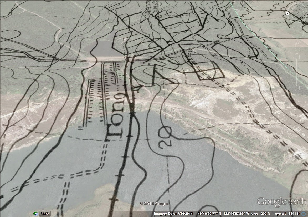
It also fits in the parallel I draw between the Rambo character and John Tornow. There is so much written about Tornow (some very recently), I’ve always wondered what the fascination was. Tornow, at least on the surface, doesn’t reveal any greater truth. Unbalanced man either murders or is accused of murder. People chase him down, a few deaths later, he gets killed.

But, if you look at Tornow through the lens of Rambo, you see something deeper. It lets you look back on the society that is turning its violence onto these men. For Rambo, he’s a recently returned Vietnam veteran targeted as a vagrant by an evil small town cop.

I’ve heard enough from small town cops to know that giving a vagrant a ride to the county line or a bus ticket out of town is at least within the realm of reality. And, Tornow shows us that a massive manhunt against Rambo was also in the realm of reality.

For the Appalachians in Grays Harbor in the early 1900s, for the Appalachians at every step in First Blood, the wild men are too far gone from society to live. They murdered, they are outside the bounds of even the libertarian Appalachian societal rules. Every man has liberty, but there is only so much liberty.

Both Tornow and Rambo are also both experts. Rambo is a highly trained commando, the cops that come after him are hopeless against his killing skills. He seeks to come back into society, but he falls back onto his training and the war.

Tornow was an actual outdoorsman, more at home (according to biographers) than in a town or among society. He was able to live off the land while being hunted for over a year and a half, feeding himself with what he had around him in the deep woods.

And, that is what I think is the larger truth about Tornow. If the Scots-Irish, the genetic base of the Appalachian DNA had finally run out of new territory to conquer in Cascadia (also explored in Sometimes a Great Notion), then they were almost ready to run down the last Wilderness. Tornow was a representative of that wilderness.

Sure, Appalachians are much more libertarian, every-man-for-himself than other sorts of North American society. Rules don’t necessarily work for them, but they are also the shock troops of a larger society against the wilderness, or agains the native inhabitants.

So, in dramatic stories about Appalachian outcasts, John Tornow and John Rambo must be hunted down.

Boy, they really scraped the heck out of old Tono

I’ve written a few times about Tono, here at this blog and over at Thurston Talk.

The thing that surprises me every time I run into details about that old town is how total the destruction was. The town doesn’t just not exist anymore, it was decimated. The very soil that it was on was moved away.

For the uninitiated, Tono was a small coal town just south of Bucoda and Tenino. From my Thurston Talk piece:

In 1932, as the Union Pacific was shifting from coal to diesel engines, the rail line sold the mines and the town to the Bucoda Mining Company. By the 1950s, most of the old town had disappeared and the mines closed down. Some of the old buildings were moved into neighboring towns. Only one couple, residing in the old superintendent’s house, stayed on the site through the 1970s. 

In 1969 coal mining in the fields around to the Tono site was revived when the Pacific Power and Light company bought the land and built a new steam plant to produce power. It was during this era that the Tono site saw its largest change. The ground on which the town had sat was scraped up, in order to get to the coal beneath it. The coal mining terraforming was so severe that the town site is currently dominated by two massive ponds.

I’ve done overlays of old Tono before, using aerial photos from the USGS, but recently I ran into some coal maps that are published online by state DNR. These are just fascinating. Two hand drawn maps from the middle part of the century add a new level of detail to the Tono site that I wasn’t able to see with the USGS aerials.

Take a look at this one in particular overlayed in Google Earth:

You can see that originally Tono was located in a small valley. But, in the 1960s, that valley was deepened and widened to locate the last coal deposits below the old townsite. And, if I’m correct in reading the map, the original coal field serviced by Tono was located south and east of town.
Lastly, the single structure I’ve seen out there (not up close) certainly is in the wrong spot to be part of the old townsite. If it is of the same vintage, it is likely connected to the mine operation itself.

Death of a Local Biz, frozen, lizards and a stone (Olyblogosphere for December 8, 2014)

1. Things freeze here.

2. OMG. You can enjoy Olysketcher in print. All year long.

3. Birds, Bees & Butterflies: Looking for a Salamander on Thanksgiving.

4. I like this photo, but I think it should’ve been titled “Stone in the Midst of All.”

Not All That Shimmers,” by Diablo_119 in the Olympia Pool on flickr.

5. And, finally. Over at r/olympia: Dino’s Dinner, death of a local business.

Just because Bud Blake won a county commission seat doesn’t mean an independent can win in the 22nd LD

When you think about politics in Thurston County, the 22nd legislative district is the Democratic liberal juicy middle in what is a pretty typical rural or suburban western Washington county. This is where the urban communities are, this is where the liberals are.

This is a district that hasn’t elected a Republican since 1980 when W.H Garson of Tenino went to the legislative building. This is also when the 22nd LD was big enough geographically to send someone from Tenino to the legislative building.

Just a side note: since Thurston County population shot through the roof in the 1970s, I’d assume that redistricting was particularly unkind to Republicans in the 22nd in the 1980s. What probably happened was the district shrank geographically given the boost of urban population, giving it its liberal contour today.

Anyway.

Bud Blake was the first conservative to win a county commissioner seat in Thurston County for a long time, most likely because he ran as an independent against a Democratic. And, he won in a convincing fashion.

I was wondering if a county-wide election for a Republican in independent clothing meant the same sort of strategy could equal the same result in the smaller, liberal 22nd LD. Well, it does not.

But, man, it would be close. If you isolate the 22nd LD precincts (the way I did in that link above), you see a pretty tight race. Democrat Karen Valenzuela would have won with just over 51 percent, or 2,000 votes out of over 40,000.

But, a win is still a win.

That said, I think a legislative race would have been even harder for an independent (especially a conservative one) to win over a Democrat. I suspect that strictly partisan issues (like abortion, environmental protection, taxes) could be isolated in a way that they couldn’t be on a local general government election.

Ebenezer Howard, 3 Magnets and the bad bad City Beautiful

Just below the surface of the best new place in Olympia, the 3 Magnets Brewpub, is a fascinating way to look at cities and communities.

One of the 3 Magnets owners vaguely references the ideas of Howard here:

“Three Magnets is based on a 115-year-old book called Garden Cities of To-morrow by Ebenezer Howard,” explains Sara. ”Basically, Ebenezer considered himself an inventor of the perfect community. He thought he could take the best of both rural and urban living and blend them into a perfect town-country. When reading this, everything called out to us as Olympia, either what we are or what we strive to be.”

So, to delve more specifically into the imagery, the three magnets are “Town,” “Country,” and “Town Country.”

More:

It proposed the creation of new suburban towns of limited size, planned in advance, and surrounded by a permanent belt of agricultural land. These Garden cities were used as the model for many suburbs. Howard believed that such Garden Cities were the perfect blend of city and nature.Howard believed that a new civilisation could be found by marrying the town and the country.The towns would be largely independent, managed by the citizens who had an economic interest in them, and financed by ground rents on the Georgist model. The land on which they were to be built was to be owned by a group of trustees and leased to the citizens.

So, in at least not in an intentional way, this sounds a lot like what people in Olympia would like Olympia to be, post Growth Management Act. Lots of rural space around us for small scale agriculture, vibrant urban community on a human scale.

So, if you’re following me so far, this sounds pretty typical. Nothing special here, just a reference back to a nice idea that we might draw from.

But, then there’s the City Beautiful Movement. If you’ve listened for more than five minutes about any discussion about Capitol Lake or the so-called isthmus, you’re familiar with this term. I think its a bunch of bunk myself. It was a short lived, classist and based on importing old world esthetics and pasting them onto North American cities. Just dumb.

Both the Garden City (Howards’) and the City Beautiful movement came along at the same point in history, when people were facing the pressures of dealing with industrialization and urbanization:

While the Garden City movement shaped a design aesthetic and pattern for satellite towns, the City Beautiful movement was aimed at restructuring American downtowns around a coordinated ideology and strategy. Just prior to the 20th century, America was becoming an international economic power, and its cities were in need of an urban form indicative of the new national identity. America’s cities were fraught with problems, and the City Beautiful movement helped provide a physical form for the previously established Public Health Movement. The City Beautiful movement envisioned the city as an entire work of architecture; its practitioners insisted that all construction conform to a singular vision. They believed that cities had failed and that a new expression of values would inspire good government and public stewardship.

He envisioned Garden Cities as compact, transit-oriented communities surrounded by greenbelts of natural landscape; they were to contain all the pieces of a town, integrating residential, commercial, industrial, landscape and agricultural uses. Howard authored the first radial city plan, which is a useful diagram for city planning even today. Garden City architectural styles were diverse but inspired by expressive, picturesque and romantic designs appropriate to natural settings.

We’re not facing the same pressures that urban leaders in the 1890s faced. Instead of trying to make urban areas livable because of pressure from industrialization and population growth, we’re trying to make them vibrant to fight against suburbanization. Thurston County is already one of the most sprawled counties in the country. We want people to be in downtown Olympia because it is a nice place to be.

And, it seems like the diversity offered in the Garden City ideal, rather than the monolith of the City Beautiful Movement, offers a much better answer. It speaks to making the country productive while also making our city livable.

Happy Thanksgiving, Olympia 1852

A far as my lazy bones are concerned, 1852 is the earliest point you can really go and see what Olympia was all about. The Columbian (between 1852-53) is available online via a searchable database.

And, from that source, we can see what Thanksgiving was like in that early Olympia fall:

Olympia existed, but it was still a part of Oregon itself, the Columbia or Washington Territory was still yet to be born the following spring. A convention had just been held advocating for secession from Oregon. And, yet, even still, the governor of Oregon couldn’t bother to let Northern Oregon know when Thanksgiving was going to be.
The late date of 1852’s Thanksgiving in the unified Oregon is a nod towards the squishiness of our most American holiday. Only six years before had a Thanksgiving campaign been started and it wasn’t until the 1860s that Lincoln got around to the national holiday.
If you then scroll back to near where we celebrate Thanksgiving now (the Saturday, November 27, 1852 edition), the Columbian features a letter to the editor that marks a much more important celebration for Olympians. The Monday before had been the first day of school in the city.

Set aside the “idleness of Indians” (because Indians weren’t and aren’t idle), the letter spells out a pretty interesting vision of America, education and civic life.

To a point Thanksgiving has now retreated back into the family. Like that, education is often seen as a benefit to family (if I don’t have kids, why should I pay for schools?) and not the community. This letter seems to point out that there was always that sort of short-minded counter argument to public education:

Think of it ye calculating men on this side of the continent, who let a few dollars (perhaps a single day’s work), stand in the way of educating your children. Do you say there is less need of education now than two hundred years ago? Will there be no need in the future of intelligent men and women?

The letter writer harkens back to the educational standard set by the most New England of New Englanders, the Pilgrims. And, of course, Olympia in 1852 was at the moment being settled by communitarian New Englanders and individualistic Appalachians. This debate on education was part of the friction between the two groups that eventually made us the way we are today around here.

And, yet, we still have the debate. Enshrined in the 1889 state constitution is the paramount duty of education, carried forward by the Pilgrim tradition written about in 1852. Hardly anyone argues that we shouldn’t have schools at all, but we’re working hard to avert our eyes from the promise our state made. And, the pressures that keep us away from that promise certainly are the same ones that talk about low taxes, smaller government and the power of the individual over the community.

So, happy Thanksgiving. Be thankful some New Englanders opened a school in late November 1852. Otherwise we’d wouldn’t be “a people too enlightened to be enslaved, too virtuous to be bought.”

Look at how Smith Troy is smiling

Note: (April 20, 2015) I got a load of details wrong writing this post. I’ve corrected them in this updated post. But, I’ll leave them here for you to read and enjoy. Just not facts though, just an Emmett story.

He literally snuck back into town to take the oath of office.

He looks like he just ate the bird.

Or, he’s just really super happy to be home after years at war. So, there should be some of that. But, I think there’s a healthy dose of having gotten one over on room full of befuddled old men who would have like to replace him while he was gone.

From the AG’s official history:

From 1943 to 1945, General Troy served in the Army in Europe as
Lieutenant Colonel Troy and earned five battle stars. During this time,
Troy’s deputy served as acting Attorney General.

This apparently was quit the coup for Troy. If normal process had been followed, Troy would have resigned and the governor would have appointed a replacement. But, Troy was able to write an opinion that his deputy serve for him and run for office in 1944 while serving.

The other people in the room look kind of surprised to be at a swearing in ceremony:

 Seems like Troy was actually in town for a month or so before he was sworn in at the end of August. He didn’t end up taking charge of the office again until the middle of September.

But, in the end, he was able to pull of nearly two years, AG in the war theatre, and settle back in to his seat of power, befuddled old guys on his shoulders.

What do you see in this chart? Mason County changing?

This is a chart tracking partisan returns in the 35th legislative district between 1992 and 2014. The lines track the two house seats and the dark dots, the senate. What I’m tracking here is how successful Democratic branded candidates have done over the past 20 years.

An important note before you look any further. For 2014, I switched Sen. Tim Sheldon for his challenger Irene Bowling. In you own consideration, feel free to totally ignore that, but for the sake of argument, and to make an interesting chart, I did that.

So, here’s what I see: Throwing out two uncontested years, the Democratic brand in the 35th (greater Mason County) has been eroding.

Mason County always struck me as an interesting place, the furthest inland outpost of the “Coastal Caucus” political type. I sort of wrote about this, the most non-partisan of Washington’s political regions, here.

I’ve also been thinking a lot about two other rural western Washington counties, Lewis and Grays Harbor. These two places share a river (the Chehalis), but party speaking, one is very Democratic, the other is very Republican. I’ve been wondering (baring very few other differences) why Lewis votes almost always Republican and Grays Harbor even more often Democratic.

And, I think we might be seeing that difference in action in Mason County. In the past, it seems that Shelton was very much like Grays Harbor. But now, as we move through several elections, Mason County is becoming more dependably Republican. This is the first time since at least 1992 that the 35th have returned three state legislators that won’t caucus with the Democrats.

But, what are the factors behind this label change? You can argue that the Democrats Mason County sent to the legislator were always more conservative. Sure, I can take that. Other coastal Democrats were always different than King County Democrats. At least in the modern sense.

But, why the label change? Here’s on theory: one other thing has happened in the last 10 years, urban Democrats have been focussing energy on Mason County and Tim Sheldon.

Sheldon’s break with urban Dems has been at least ten years in the making, since he chaired Democrats for Bush in 2004. He also led a rebellion against a Democratic budged in a few years ago and then famously caucused with Republicans during the last two legislative sessions. And, since then, Democrats in other parts of Puget Sound have been taking a harder and harder aim at him. The high point was this year when a traditionally funded Democrat faced off with Sheldon in the general, and lost.

So, maybe this really isn’t an act of Mason County voters changing their stripes, but a slow-motion erosion of the old-style coastal Dem with a modern conservative Republican.

Low voter turnout and why aren’t we celebrating Washington’s 135th anniversary?

Two big surprises this week. Well, they aren’t big surprises at all. Washington State turned 125. Also, voter turnout during this off year election in the second term of a Democratic president was really low in the same state.

These two things are actually connected in a very interesting way. The reason we’re not celebrating the 135th anniversary of Washington is the same reason voter turnout is down to historic levels this year in Washington.

It was political division and apathy that kept Washington out of the union in the late 1870s, ten years before their successful 1889 effort.

Robert Fricken in Washington Territory:

Washington Territory was divided, rather than united, upon the question of statehood. Longtime, often bitter, points of contention remained paramount, setting westerners against easterners, Republicans against Democrats, and Portland influence against the challenge of Puget Sound.

Fricken is the bomb, by the way. Everyone should read every one of his books.

Washington remained a state in uretero for so long, because it wasn’t a single cogent state. As Fricken points out, the Puget Sound was an economic colony of San Francisco and Eastern Washington was controlled by the Willamette. Also, decades and decades of rule by the east compounded on themselves, and the political culture that would grow with the promise of self rule never flourished.

Voter participation also dropped off significantly from areas that supported statehood at the time (Puget Sound) to places where it wasn’t supported (east of the mountains). In places where there was little engagement for the goal, voters overall failed to answer the question.

It wasn’t until the 1880s when Washington’s population went from 75,000 to over 300,000 did the question come up again. Also, because of a rail connection through Washington to the rest of the country, the territory was at last united.

That 1870s apathy towards statehood, driven by disunion and apathy, is the same sort of thing we face today.

While we lacked a railroad to throw off the shackles of Portland and San Francisco, today we shackle ourselves away from each other. Our redisticting process, at both the legislative and Congressional level, has shifted partisans into seperate districts. If we ask voters to vote in races that don’t matter, they won’t vote.

Jim Bruner in the Seattle Times back in 2012:

In an interview, Milem said the commission’s priority of protecting
incumbents was evident in the new maps, as incumbents of both parties
got safer seats.

Milem is correct on that point.

Just look U.S. Rep. Dave Reichert’s 8th Congressional District.
Previously a suburban swing district, the 8th was redrawn by the
commission to become solidly Republican. The new district lost its
Bellevue and Mercer Island portions and now crosses the Cascades to pick
up Wenatchee and Ellensburg.

Similarly, the 2nd and 9th Districts were redrawn to be safer for their Democratic incumbents, Rick Larsen and Adam Smith.

“We’ve lost electoral competition in those districts as a result of the plan,” said Milem.

That holds true for many state legislative districts too. Milem says
partisan considerations trumped the goal of drawing logical district
boundaries, leading to some strange contortions.

For example, Milem describes the shape of the 18th legislative district near Vancouver as “one arm short of a swastika.”

Sure, we’re also sorting ourselves out in a larger sesnse. But, in the least, creating as interesting and compelling political boundaries in the first place would help.

« Older posts Newer posts »

© 2025 Olympia Time

Theme by Anders NorenUp ↑