History, politics, people of Oly WA

Category: Tono

Tono, actually

One of the historic rabbit holes I’m prone to falling down is the lost cities in Washington State. I don’t mean ghost towns, because some of them, like Tono in southern Thurston County, don’t exist at all anymore.

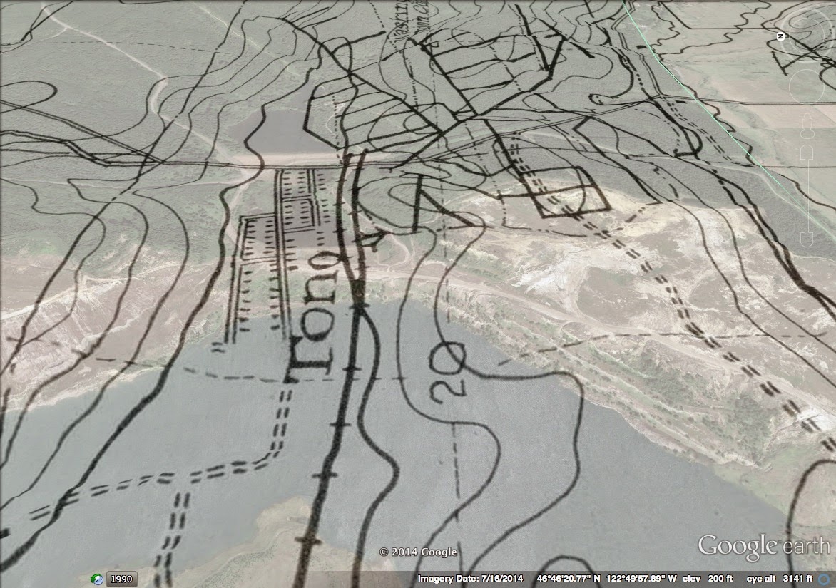
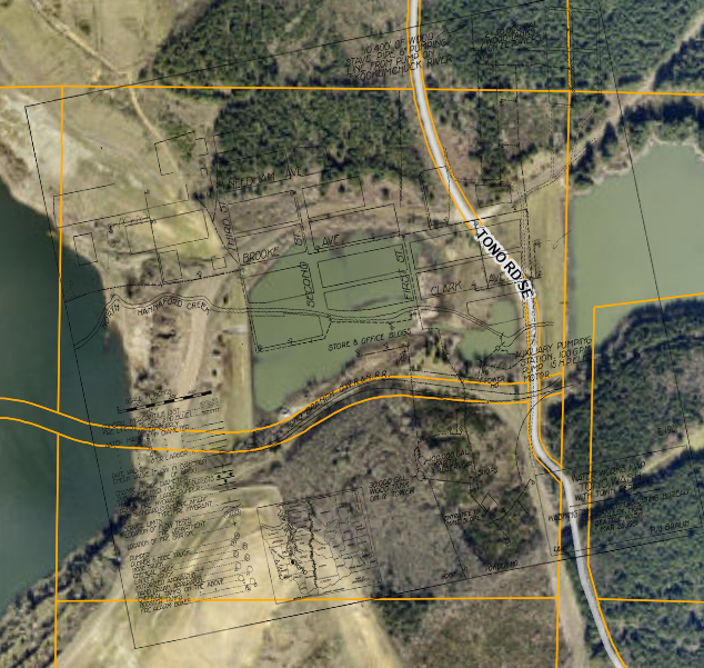
Over the years, I’ve tried to pinpoint exactly where Tono was located. Recently, I was looking at the parcel layer (the map showing property boundaries) in southern Thurston County (as I’m sure we all do from time to time), just below Bucoda. And, I noticed a long, skinny parcel that, to me, indicated a road or a railroad was once there.

So, I went back and found a fairly decent map of Tono that included a train line. The train line’s contour matched the parcel’s shape, and it lined up nearly perfectly.

This is the best I’ve been able to produce of how Tono was laid out.

This is significant because the landscape of Tono disappeared when mining techniques changed after the town itself was abandoned.

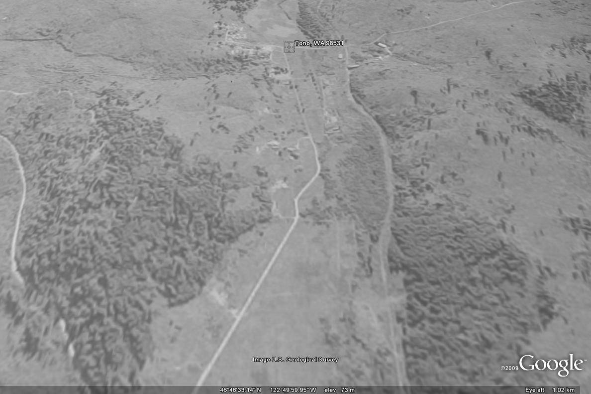
In 1969 coal mining in the fields around the Tono site was revived when the Pacific Power and Light company bought the land and built a new steam plant to produce power. It was during this era that the Tono site saw its largest change. The ground on which the town had sat was scraped up in order to get to the coal beneath it. The coal mining terraforming was so severe that the town site is currently dominated by two massive ponds.

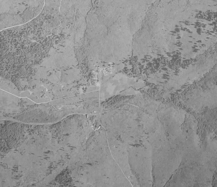
For decades, Tono had been a fairly significant town in Thurston County, on par with Yelm, Tenino, and Tumwater. But because it was a company town, when the resource ran out, the town itself ran out of reasons to exist.

What I keep coming back to is how completely Tono was erased. There was no fight over historic districts, no argument about “character,” no committee meeting where someone insisted their grandfather once lived in a particular house and demanded the coal company spare the building. The ground was literally peeled back; the past scraped away to get at what the land still had left to give. What’s left now are ponds big enough to swallow the entire town grid.

And yet, somehow, Tono survives.

Tono survives in census tables, photos, mining reports, and the stubborn curiosity of anyone who has ever tried, like I have, to find the ghost of a town that isn’t even a ghost.

It’s funny: we spend so much energy today trying to keep the past standing upright. We landmark houses whose only real significance is their ability to slow down a duplex development. We wrap ourselves around “character” as if it were a fragile antique rather than something living communities constantly renegotiate.

Tono is a lesson in impermanence so complete I can’t help but be amazed. An entire town, just gone.

Two ponds where families once lived. You couldn’t “preserve” Tono if you tried; the coal company settled the question half a century ago. And yet, that doesn’t make it any less historical. If anything, it makes it more so. Tono forces you to engage with history as a process, not a museum exhibit. You can’t stand in the middle of a preserved streetscape and pretend the past is still intact, because the flow from the past to today is change. Change even includes the scraping of an entire landscape until there is nothing left.

You have to reconstruct it. You have to work for it. And there’s something freeing in that.

The lesson of Tono, the one that historians, preservationists, and anyone who loves their community ought to sit with, is that losing the physical stuff isn’t the same as losing the history. The built environment is not the memory. The map I matched by lining up an old railroad grade with a weirdly long modern parcel tells me more about Tono’s rise and fall than any building would. The ponds tell a truth the hardware store never could: the town’s existence was always dependent on what lay beneath it.

We forget that history is supposed to breathe. Towns grow, plateau, disappear, reappear in footnotes, and get rediscovered in GIS layers. Some places make it. Some fade. And sometimes the fading is the story.

Tono reminds me that you can lose every house, every street, every trace of a community’s physical presence, and still have history worth knowing. You don’t need to encase it in glass to make it matter. You don’t need to keep a structure standing to let the story breathe.

Boy, they really scraped the heck out of old Tono

I’ve written a few times about Tono, here at this blog and over at Thurston Talk.

The thing that surprises me every time I run into details about that old town is how total the destruction was. The town doesn’t just not exist anymore, it was decimated. The very soil that it was on was moved away.

For the uninitiated, Tono was a small coal town just south of Bucoda and Tenino. From my Thurston Talk piece:

In 1932, as the Union Pacific was shifting from coal to diesel engines, the rail line sold the mines and the town to the Bucoda Mining Company. By the 1950s, most of the old town had disappeared and the mines closed down. Some of the old buildings were moved into neighboring towns. Only one couple, residing in the old superintendent’s house, stayed on the site through the 1970s. 

In 1969 coal mining in the fields around to the Tono site was revived when the Pacific Power and Light company bought the land and built a new steam plant to produce power. It was during this era that the Tono site saw its largest change. The ground on which the town had sat was scraped up, in order to get to the coal beneath it. The coal mining terraforming was so severe that the town site is currently dominated by two massive ponds.

I’ve done overlays of old Tono before, using aerial photos from the USGS, but recently I ran into some coal maps that are published online by state DNR. These are just fascinating. Two hand drawn maps from the middle part of the century add a new level of detail to the Tono site that I wasn’t able to see with the USGS aerials.

Take a look at this one in particular overlayed in Google Earth:

You can see that originally Tono was located in a small valley. But, in the 1960s, that valley was deepened and widened to locate the last coal deposits below the old townsite. And, if I’m correct in reading the map, the original coal field serviced by Tono was located south and east of town.
Lastly, the single structure I’ve seen out there (not up close) certainly is in the wrong spot to be part of the old townsite. If it is of the same vintage, it is likely connected to the mine operation itself.

Tono’s landscape

This is an attempt to show how the landscape of the old Tono site has changed in the decades since it was an actual town.

Here is a good a picture as any to show the general flat nature of the town in the early part of the last century (from UW Digital Archives):

Here is a aerial photo of the town in 1940 overlaid in Google Earth with today’s topography, at a low angle, so you can see the warped layout of the town.
And, this is nearly the same perspective with the overlay at around 70 percent so you can see the current sediment ponds where roads had been.

This is the amazing part of Tono for me, not that its a ghost town, but that only a small pocket (on the southwest corner of town) was untouched after the it was abandoned and then the site was strip mined.

Tono, Washington

If anyone is wondering, USGS Earth Explorer sometimes publishes upside down historic aerial photos, thereby making it easy for people to mistake one town for another. On the original version of this post I used an upside down version of Bucoda, Tono’s neighbor to the northwest. 


Below is the real Tono, circa 1941, well past its prime. But, you can still see where the town certainly was.

Source: USGS Earth Exporer

Halfway through a random Sunday drive through southern Thurston County, I thought it might be interesting to see if we could get all the way up to the old Tono townsite. I’d read about Tono before, and after looking at where the old town was on a map, I thought there was no way the current landowners (Transalta) left the Tono Road open so anyone could drive up.

The road is no only still open, but paved with plenty of places to pull out and take a look. Transalata would probably prefer you not hike out too far, but let’s just say its possible.

We made it all the way to the old town site. From the road you can see at least one old building, but other than that, there is no real evidence that anything at all existed here.


View Larger Map

This is most likely because of the extensive strip mining in the area since the town went into decline in the early 1930s. Tono was a coal town, and specifically, a coal for trains town. When the switch was made to diesel, towns like Tono had no real reason to exist.

The most interesting thing was locating an aerial photo of Tono (above). That shot is from June 1941, a probably catches Tono on its very last steps out. More than 20 years past its peak, there is very little on that photo that still exists today and much of what is the north part of town, is no under water  in two sediment ponds.

Tono from Asahel Curtis Photo Company Photographs from UW Special Collections (more photos):

© 2025 Olympia Time

Theme by Anders NorenUp ↑