History, politics, people of Oly WA

Category: history (Page 2 of 2)

Foster vs. Gorton, reliving the 60s with redistricting

Since the redistricting commission technically still has time, they might as well take it:

Having already surpassed their self-imposed deadline of finishing in November, members of the Washington State Redistricting Commission said there is still more work to do and that a final deal likely wouldn’t come before next week. The commission has an official New Year’s Day deadline, or else the duty is sent to the state Supreme Court.

I’ve tried to see if anyone has mentioned this little historic fact, but this isn’t the same time that Dean Foster and Slade Gorton have dueled over redistricting Washington State’s political boundaries. The Secretary of State’s blog pointed out Gorton’s role, but ignored Foster’s.

Gov. Dan Evans signing the eventual redistricting law in 1965.

Highlight showing Gorton and Foster looking over his shoulder.

 Both Foster and Gorton were young participants during the contentious 1963 redistricting effort. Gorton was the redistricting leader for the Republicans in the legislature while Foster worked as a vital young staffer for the Democratic leadership.

Late last night I read the portion of the new book on Gorton that covered his role in the 1963 session (a pdf of the book is available free at the Secretary of State’s website):

(Democratic senate leader Bob) Greive consigned the House bill to committee. The sorcerer had a gifted apprentice of his own. Young Dean Foster ran the numbers, tweaked the majority leader’s plan and gave him something to shop around on the
House floor. (Slade) Gorton warned that two could play that game.

A lot of people, including some members of his own party, were wary of Slade “because he could just outsmart anybody,” Don Eldridge said. But  Greive  had  way  more  detractors  and  clearly  had  met  his  match  in Gorton. “I tell you, the two of them, that was a combination,” the GOP caucus chairman said. “I’d liked to have been a little mouse in the corner at some of those sessions.” 18  Pritchard said Greive was “Machiavelli on redistricting. He was too smart for everybody . . . until he ran into Gorton,” who “knew every jot, diddle, corner — whatever it was.

Grieve himself had some observations of the 1963 during his own oral history with the Secretary of State’s office. Foster was so important that he would send state patrol cars from Olympia to Bellingham to pick up Foster from college:

Ms.  Boswell:  Dean  Foster  has  told  some humorous stories about you coming to pick him up in Bellingham and sending an escort to get him when you needed him to work.   He was still a college student right, during much of it?

Sen. Greive: As I understand it, he was.  I don’t think he was going to school while we were  in  the  session,  but  I’m  not  sure.   The other  thing  about  Foster  is  that  he  had  a tremendous capacity for work, as did Hayes. In  other  words,  he  understood  what  was important.    He  understood  the  question  of timing and everything else.

Ms. Boswell: Do you remember sending some state  patrolman  to  get  him?    Tell  me  about
that. 

Sen. Greive: In those days we had control of the state patrol’s very existence and anything that we wanted that dealt with the Legislature, they  were  “ours.”    They  were  most accommodating as long as it was something in an official capacity.  If the majority leader in the Senate, or the chairman of redistricting or whomever, had something he had to have, they would accommodate you.  They did that for a lot of other things.  I wasn’t the only one who did it.  But I did send the state patrol up to get him and take him down there to Olympia if I needed him.  Of course I’d phoned them first and cleared it with them.

I really doubt Foster is getting rides from the state patrol this time around.

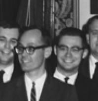
Foster pictured from this 1965 article.

Its amazing now with the aid of freely available tools like this, that seemingly everyone (including me) can produce their own set of maps. The process this year even included a DIY section for the rest of us. But, almost 50 years ago, the data was so difficult to parse and the politics so divisive (the legislature itself drew the maps), you almost have to wonder why it even takes as long as it does today.

In the end, how did all that effort in the 1960s work out? Well, let’s just say that hopefully we do better this time:

1963:

It was unlikely in such a contentious political climate that legislators could come to a decision on a partisan issue like redistricting, and indeed, the regular session closed without any agreement. Governor Albert Rosellini immediately called a special session, but after 23 days, it, too, ended with no redistricting plan.

1964:

The Court demanded a speedy solution to the redistricting roadblock, but the order did not guarantee that one would be found. Weary legislators also wanted to establish a redistricting plan as quickly as possible, but knew it had to be acceptable to elected officials as well as the voters.

1965:

After forty-seven days of debate, discussion, compromise, and open hostility, the Legislature finally passed a redistricting plan. The measure called for forty-nine senatorial districts, with one member elected from each district, and fifty-six legislative districts

Tono’s landscape

This is an attempt to show how the landscape of the old Tono site has changed in the decades since it was an actual town.

Here is a good a picture as any to show the general flat nature of the town in the early part of the last century (from UW Digital Archives):

Here is a aerial photo of the town in 1940 overlaid in Google Earth with today’s topography, at a low angle, so you can see the warped layout of the town.
And, this is nearly the same perspective with the overlay at around 70 percent so you can see the current sediment ponds where roads had been.

This is the amazing part of Tono for me, not that its a ghost town, but that only a small pocket (on the southwest corner of town) was untouched after the it was abandoned and then the site was strip mined.

Tono, Washington

If anyone is wondering, USGS Earth Explorer sometimes publishes upside down historic aerial photos, thereby making it easy for people to mistake one town for another. On the original version of this post I used an upside down version of Bucoda, Tono’s neighbor to the northwest. 


Below is the real Tono, circa 1941, well past its prime. But, you can still see where the town certainly was.

Source: USGS Earth Exporer

Halfway through a random Sunday drive through southern Thurston County, I thought it might be interesting to see if we could get all the way up to the old Tono townsite. I’d read about Tono before, and after looking at where the old town was on a map, I thought there was no way the current landowners (Transalta) left the Tono Road open so anyone could drive up.

The road is no only still open, but paved with plenty of places to pull out and take a look. Transalata would probably prefer you not hike out too far, but let’s just say its possible.

We made it all the way to the old town site. From the road you can see at least one old building, but other than that, there is no real evidence that anything at all existed here.


View Larger Map

This is most likely because of the extensive strip mining in the area since the town went into decline in the early 1930s. Tono was a coal town, and specifically, a coal for trains town. When the switch was made to diesel, towns like Tono had no real reason to exist.

The most interesting thing was locating an aerial photo of Tono (above). That shot is from June 1941, a probably catches Tono on its very last steps out. More than 20 years past its peak, there is very little on that photo that still exists today and much of what is the north part of town, is no under water  in two sediment ponds.

Tono from Asahel Curtis Photo Company Photographs from UW Special Collections (more photos):

James Hannum’s two books about the history of local railroads

I was looking for a particular piece of history that I couldn’t easily find online, so I quickly checked out every book at the Olympia Timberland Library that had any relevance at all to railroads in Thurston County. Two of them — South Puget Sound Railroad Mania (a goofy name for a great book) and Gone But Not Forgotten: Abandoned Railroads of Thurston County, Washington — are insanely good books.

I’m pretty sure I’d brought home the first book before at some point, but I don’t think I gave it enough time to really realize how good it was.

In a lot of ways, the story of the South Sound can be told through transportation and by railroads. The dozens and dozens of timberland railroads explored by both books show how we really did interact with our landscape in a much different fashion in the past. Each small railroad was a different timber operator in a different corner of the region. Instead of residential homes on 5 and 10 acre parcels and hobby farms, we had a semi-industrialized, narrow gauge sort of world.

I was mostly interested in the lines that used to and still do cross Olympia. Going through the books over the weekend, I found downtown Olympia at one point had three different railroad stations.

  • Anyone that has seen the famous Olympia birds eye view knows that a railroad used to go down the west side of what is now Capitol Lake. Where 4th Avenue crosses that old railroad, there was a railroad station.
  • Most folks could also guess that the old white building between the railroad tracks and Columbia, down by Amanda Smith Way, was also a railroad station.
  • Most surprising to me, but now sort of obvious now that I realized how close it was to an existing railway line, but the Olympic Outfitters building used to be a railroad station for the Northern Union (thanks Andrew!) Pacific. The main line ran down Jefferson St. (as it does now) to the port, but a couple of lines diverged at Jefferson and 7th, ran in the middle of the block and ended at the station.

Couple of thoughts on finding ourselves in Centralia on Veterans (Armistice) Day

Based on that I’ve never been to Berry Fields (love their blueberry jam, favorite jam ever) and that we had an open morning Thursday, we found ourselves in Centralia.

It was on purpose that we went, but it was accidently that we found ourselves on that particular day, 91 years after the Centralia Massacre, when six people died in a riot between American Legionaries and Wobblies.

The events leading up to and following the massacre (riot) are well documented, the UW library even has an extensive digital library, so I’m not going to recount the larger universe around 1919 in Centralia

But, just a couple of thoughts:

1. Less than 8,000 people lived in Centralia at the time, a pretty small town. Funny note, Olympia was about the same size at the time.

Anyway, everyone who participated in the massacre knew each other and had some history between them. The two main characters of the massacre were lawyers who apparently had a decent personal relationship.

Even though there were meta-issues at play (radical labor unions vs. conservative veterans), it was the personal relationships that I think color the history. This made me think about the current debate inside the Olympia Co-op community over divestment.

2. One of my weirdest experiences as a reporter was running into a lady that was in Montesano to research one of her relatives that had (apparently) either participated in or died in the massacre. She hung out at the newspaper office for an afternoon looking through our archives and then showed up at a city council meeting in Elma later that night. The police chief realized she was a transient and gave her a bus pass to Olympia.

I hadn’t realized until she showed up at the meeting that she had no place to go and was literally living out of a backpack. She was originally from the Southwest (Arizona?) and traveled up here to simply research her relative’s connection to the Centralia massacre.

Its a pretty big thing that would drag someone up with no money from Arizona to Grays Harbor County.

Newer posts »

© 2025 Olympia Time

Theme by Anders NorenUp ↑